"So complex and interdependent was the ecosystem he and his men had entered that the jungle itself could appear to take on the attributes of a living being."
The Plan
Only having one night in Olympic National Park, we wanted to see the best it had to offer. Covering over 900,000 square acres (1400 sq mi.) seeing the entire park was a simple impossibility. We asked the rangers their suggestions and gave us three options: the mountains, the rainforest, or the coast. Never having camped on the coast, we chose the rocky banks of the Pacific for our destination.
We started at the Ozette Ranger Station and hiked on the Sand Point Trail to Sand Point. From there we went north, about a mile, and camped just in the treeline near Wedding Rocks. The next morning we completed the Sand Point Trail.
Olympic National Park
There are some remarkable landscapes in the United States—red, alien deserts, cities of rocks, the spine of the Rockies, crystal clear lakes, massive caves, etc—but nowhere has the diversity of ecosystems, the abundance of plant matter, or the jagged cold coasts quite like Olympic National Park. Visting Washington, my 48th of 48 contiguous states, Olympic was a must-see while I was there. Unfortunately, I had only one day to explore the massive park on the Puget Sound.
Olympic is the 13th largest national park out of 62, one position higher than one of my favorites, Big Bend. I’ve visited Big Bend four times, each time more than four days, and I still feel like I’m missing some parts of the park. Olympic is 120,000 square acres larger than Big Bend, and I about 24 hours to see it all.

If I asked you to identify the location of four pictures taken in Olympic, I can almost guarantee that most people would point to four very different states. The park has glacial-covered mountains, stretching pine forests, sanctuaries of oak forests, wave-crashing coastlines, and soggy, spongy, rainforests. I’m amazing it isn’t the most visited national park, because it has everything but desert.
Hurricane Ridge
Not knowing how to best spend our time in the park, we stopped at the main park headquarters, in Port Angeles. We wanted the best campsite in the park and the ranger gave us three options; the mountains, the rainforest, or the coastline. Since we had just left the North Cascades, we elected the coastline. She gave us our permits, pointed on a map where we were allowed to camp, and before we left, she told us that we had to drive up Hurricane Ridge.
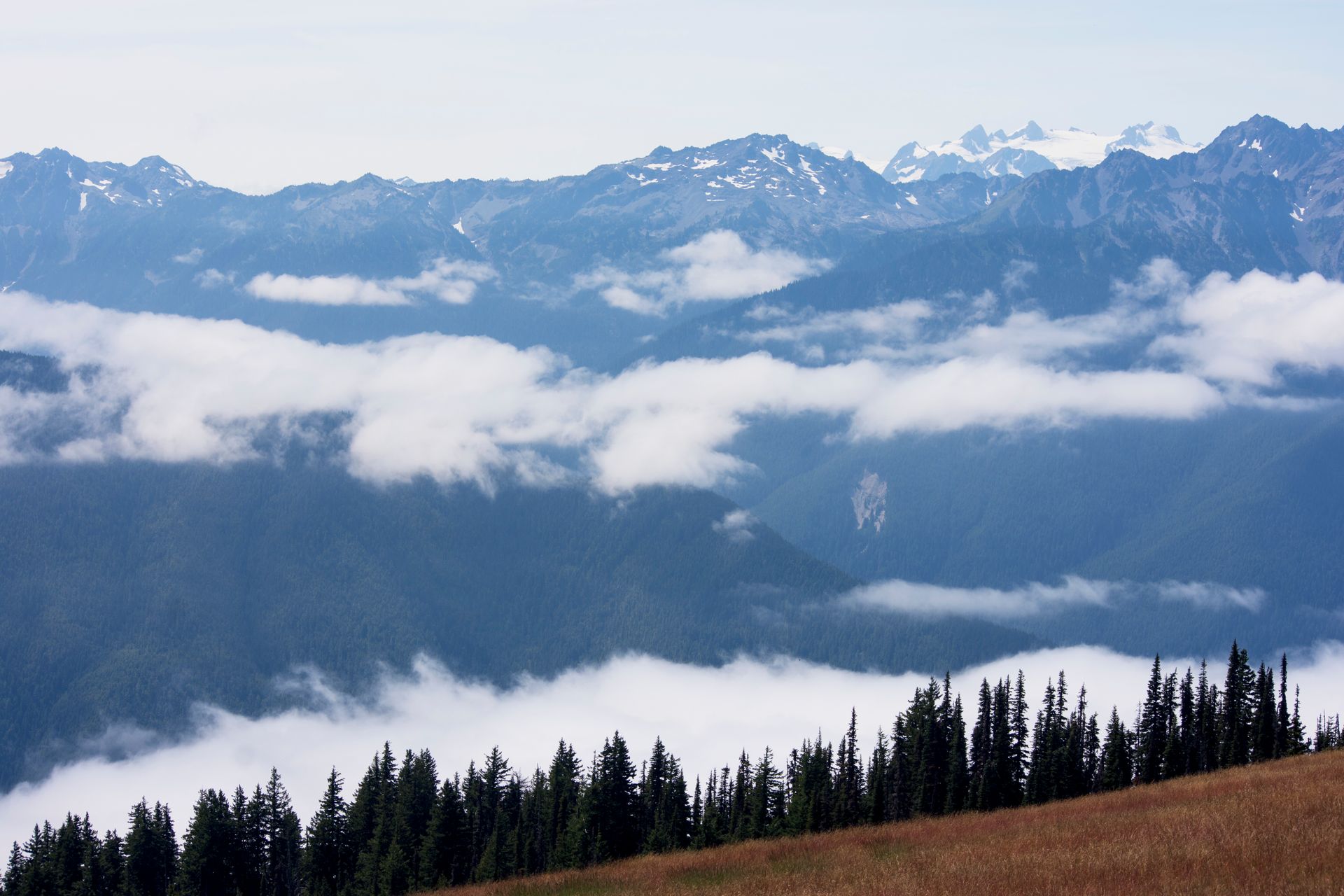
The road left the HQ and cut directly south into the heart of the national park. I’ve learned never to ignore rangers’ must-sees, so we headed down the road as soon as we left the building. Now I’ve been on a lot of amazing drives through the country and Hurricane Ridge stands solidly in the top five.
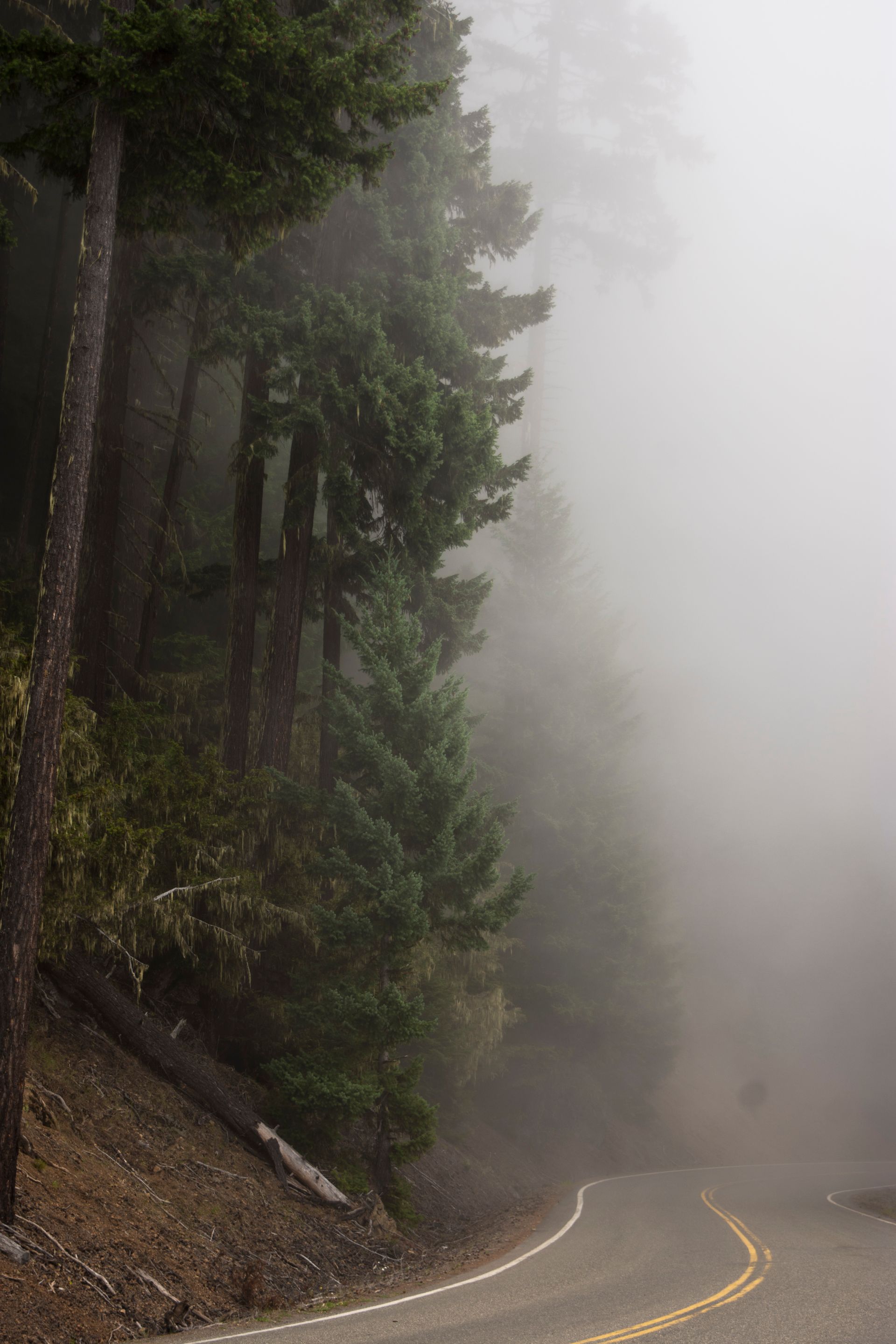
The road wound straight up the mountains. We drove through various clouds of fog and mist, through pine forest, rain forest, and oak forest, past mountains, hills, and spires, to the very top. It was a crystal clear day and nearly every spot was taken. We didn’t spend much time at Hurricane Ridge, partly because our trailhead was still two and a half hours away, so we snapped some pictures and headed out. It was well worth driving out of the way, and both my brother and I wished we could have spent more time exploring that part of the park.
Ozette to Sand Point
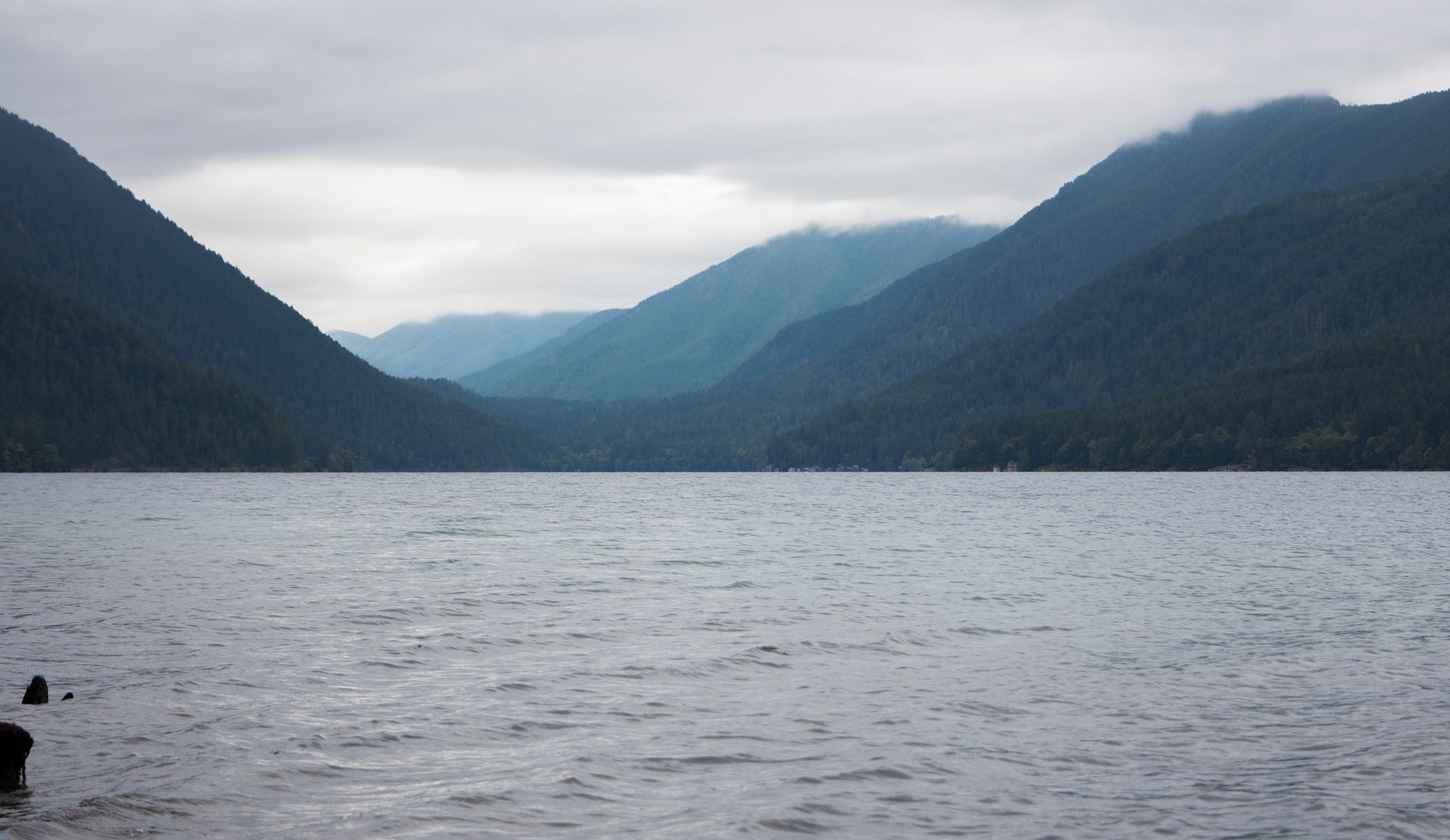
100 miles, and 2.5 hours after leaving the Hurricane Ridge parking lot, we reached the Ozette Ranger Station. On the way, we drove past lakes, forests, hills, and coastlines in a dizzying array of sublime nature. Ozette is disjointed from the rest of the park. The coastline was too beautiful to leave unprotected, yet too far from the main national park to be included with the rest of the park.
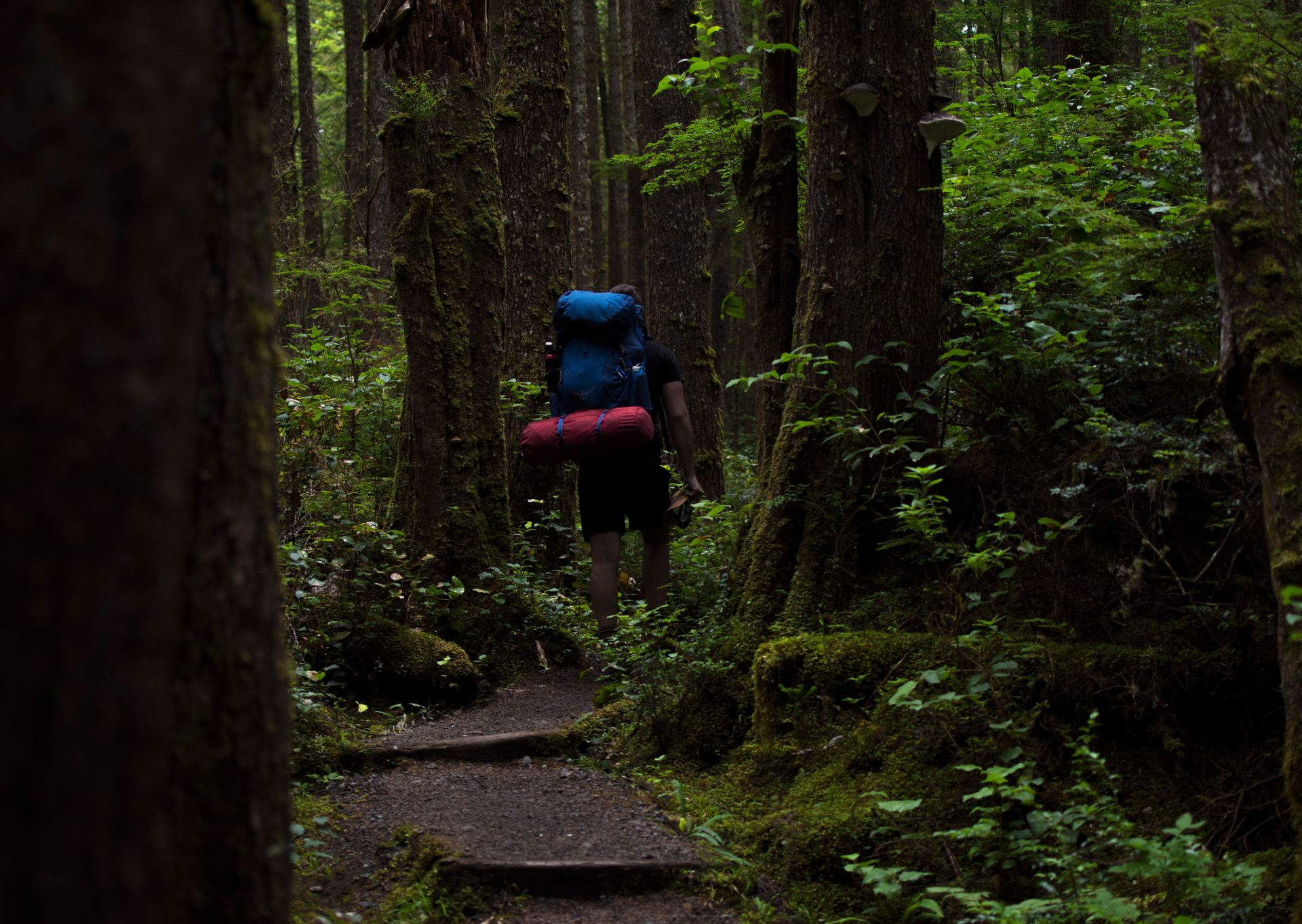
There’s a sizable parking area, which surprised me seeing how far away we were from any semblance of civilization. I was excited to get going for two reasons. I had never camped on a beach before, and the trail was right through part of the coastal rainforest. For years I had been dying to see the famed Pacific Northwest forest, and I was steps away from living out that dream.
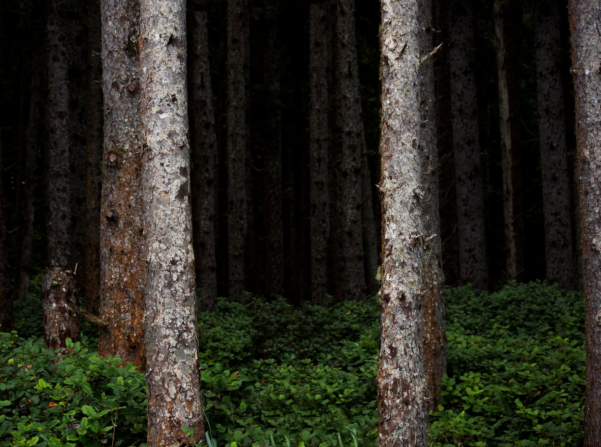
The trail was about 10 miles, in length. Three through the forest, three along the coast, and three back through the forest, making a big triangle. Right away I knew it was going to be special. The trail crossed two clear streams before the first 200 yards. A dark, dense, bright green treeline was waiting for us just across the second bridge.

I have hiked hundreds of miles. Some trails are naturally better than others. Many factors go into a nice trail, the scenery, the maintenance, the weather, your current mood, and I have to say, this trail was scoring high on all marks. Despite there being hardly any visibility through the forest, the moss, trees, roots, ferns, and vegetation made a uniquely wild scene. Sweeping vistas are my usual prey when hiking, but this was equal to any mountain-top view I had seen in terms of natural beauty. The trail itself was also fantastic. Long, wooden walkways stretched for about two and a half of the three miles. Not wanting to damage the forest floor, the park created a slightly raised pathway, making for one of the best and easiest trails I’ve ever walked.
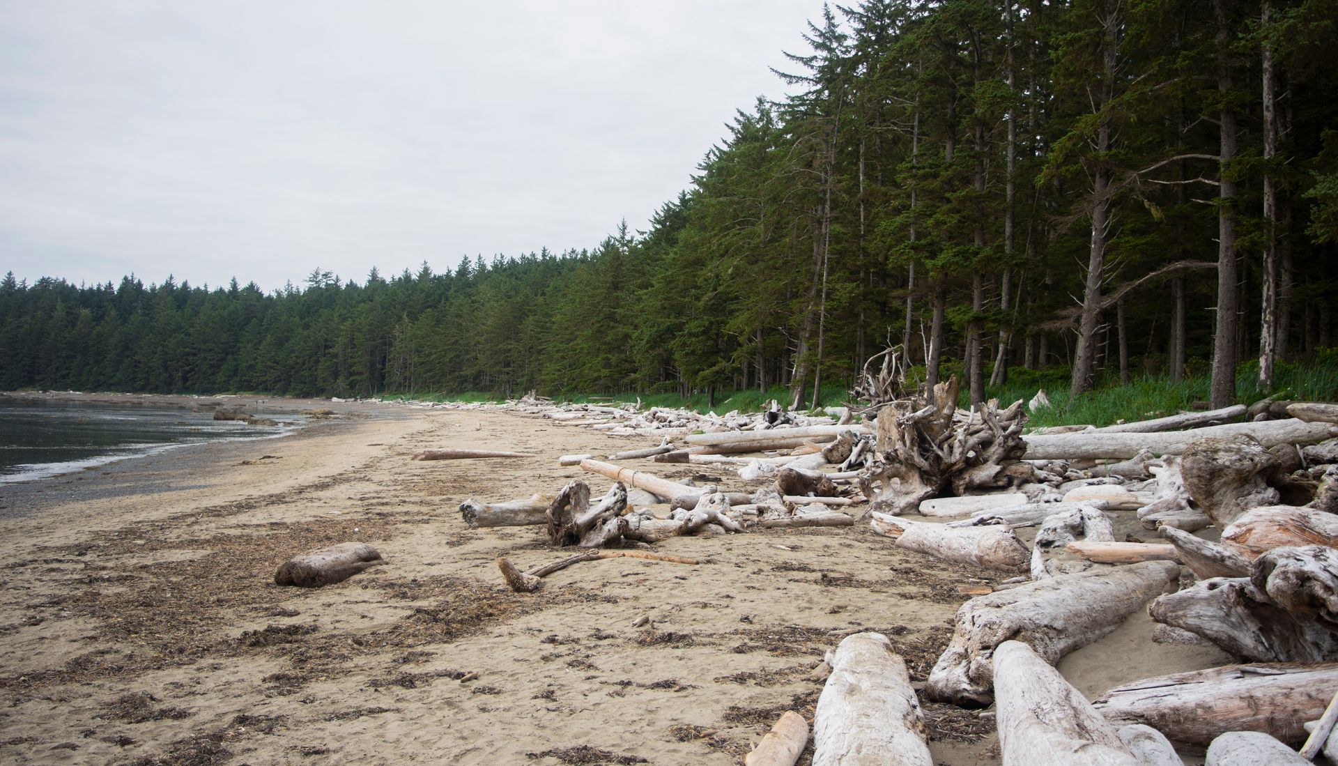
The forest regularly changed density and shade as we walked the few miles. Finally, nearing the coast, the forest suddenly stopped, and an exposed, rocky beach greeted us. The Pacific coast is gnarly, rugged, slick, and a bit smelly, but it’s the most dynamic and beautiful of any in the country.
Gulls and seals yelled as the waves splashed against the rocky shore. Walking on the beach was as nice and as unique as the forest had been. A line of massive, sun-bleached logs made a wall against the dark green forest.
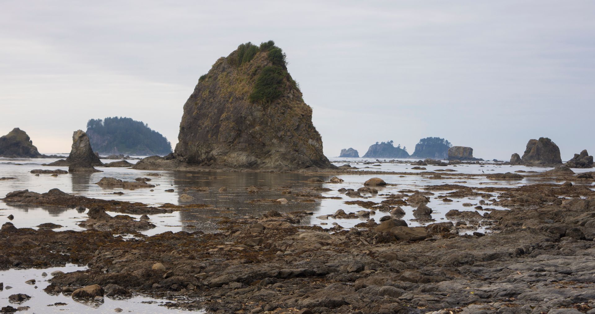
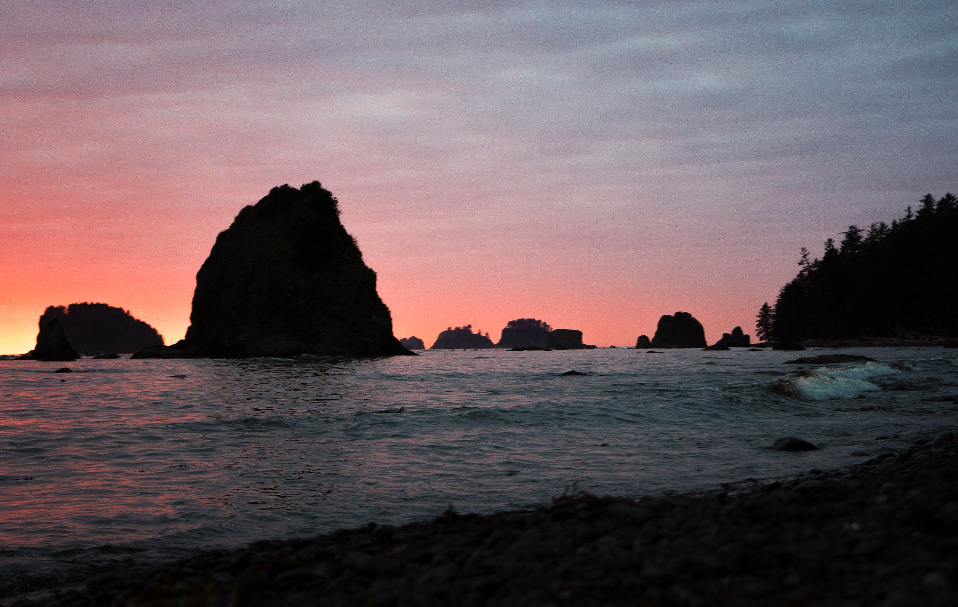
Pillars of what’s left of ancient coast floated in the distance like sails to sinking ships. The tide quickly covered our sand steps, and forced us, more than once, to find a path through the jungle.
Sand Point to Wedding Rocks
The sun was setting, and we were perfectly halfway through the hike, so we decided to find a place to set up camp. We found a designated site just in the treeline, just past Wedding Rocks - an amazing crag of stone that gets covered during high tide. Camping on the beach was allowed, but we didn’t know exactly how high the tide was supposed to come and played it safe. Also, the noises of the ocean were completed muted even though we were less than a yard into the forest.
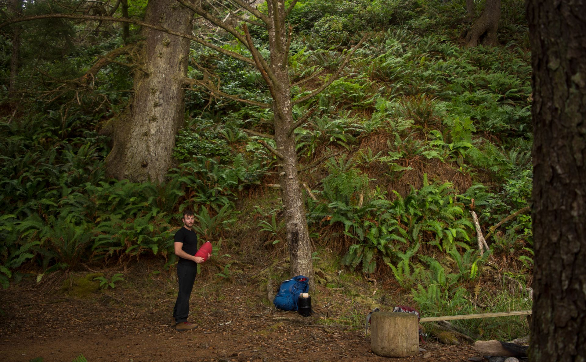
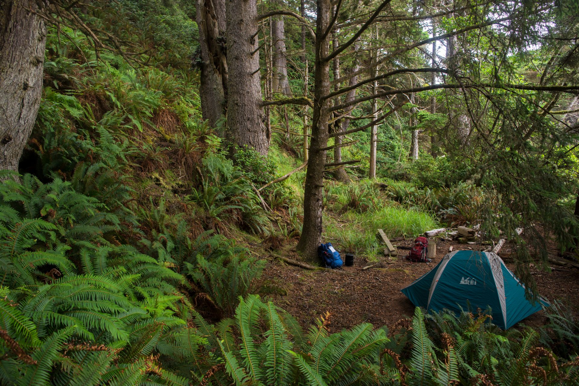
It was a perfect campsite by all accounts. We found a log on the beach and ate dinner in silence as we watched the sunset fade away over the ocean--a sight my Eastern eyes weren’t used to seeing.
The rest of the triangle was largely similar to coming in. We were out of the forest and back in our car early the next morning, with new pictures in my mind (and camera) that I would never forget. If I had a choice to revisit anyplace I had already been, it would be Olympic over anything. There was so much left to see and explore in the park, we had really only scratched the surface.