"There's a quality of life in Maine which is singular and unique. I think. It's absolutely a world onto itself."
The Great Maine Woods
As I mentioned in the Acadia post, Maine is a state of contradictions. While Acadia National Park is beautiful and a fantastic example of a New England National Park, it is also one of the most coddled, and hardly primitive. The opposite is true for nearly the entire rest of the state.
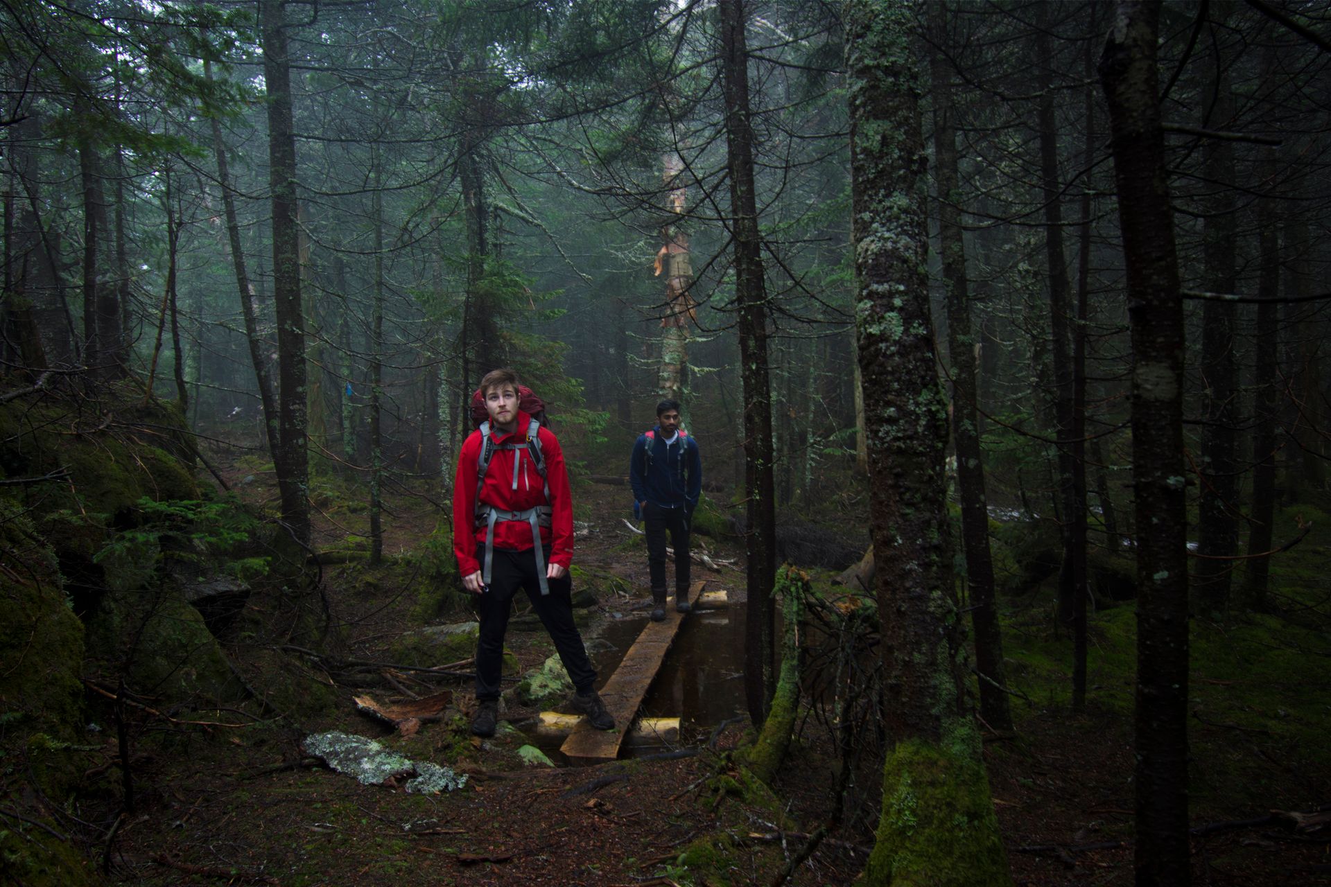
Taking a ride though Maine, you really get a sense of what some of the great northern territories must be like. Large, long roads lined with pines that stretch for hundreds of miles - with very little in between other than a few towns hidden along the way. As far as the continental United States is concerned, Maine is certainly in the running for most remote and wild. In fact, Maine's famous 100 Mile Wilderness is considered the most remote section of the AT and possible the entire country (excluding Alaska). Due to time restraints, I could not hike the 100 Mile Wilderness, but I did my best to see as much of Maine as I could while I was there. Topping the list was Baxter State Park.
Baxter State Park
Baxter is located in north-central Maine, far out of the way from almost any large population, and an effort to get to from almost anywhere else in the United States. Keeping true to the "forever wild" philosophy of the founder, Baxter may be one of the wildest state parks in the country. Inside the park there are no paved roads, running water, or even electricity (so make sure your car can handle some slightly rough roads).
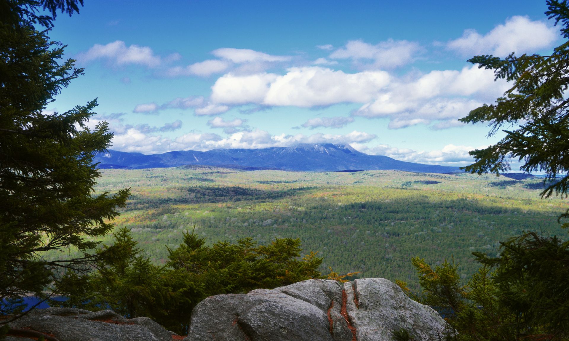
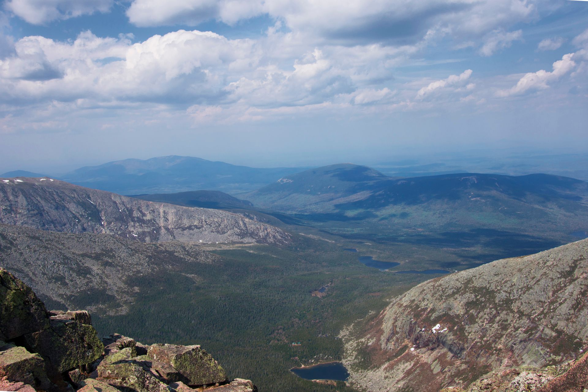
Surrounding the park is the 100 Mile Wilderness, Katahdin Woods and Waters National Monument, and various other wilderness preserves, giving the entire area and extremely untouched varnish. The centerpiece of the park is of course, Mount Katahdin, the tallest point in Maine, and the northern terminus of the famous 2,100 mile, Appalachian Trail.
Mt. Katahdin
Visiting early in the season limited our options to the top. The most famous ascent is the Knife's Edge trail, unfortunately, that option was closed, and we settled with the Abol trail - a 3.5 mile straight shot to the summit.
Working our way up the side of the mountain we ran into a fellow hiker with a massive backpack. He was huffing and puffing his way down the trail and walked with us a bit. He explained how he was starting the Appalachian Trail going southbound, he was on his first day. With no backpacking experience, he packed up a bag and made it all the way from Florida to Maine. We were concerned, however, because his backpack weighed in over 50 pounds, the average AT backpack usually weighs in at half that. He was also completely out of his element and we urged him to go back to the park and re-evaluate his gear.
Red in the face, and only half a mile down the trail, he finally agreed and turned around to drop some gear. We didn't hear from him again, but I hope he is somewhere on the trail now. Remember, the AT is a serious undertaking, make sure you have backpacking experience, done you research, and have gone on plenty of shakedown hikes before heading out!
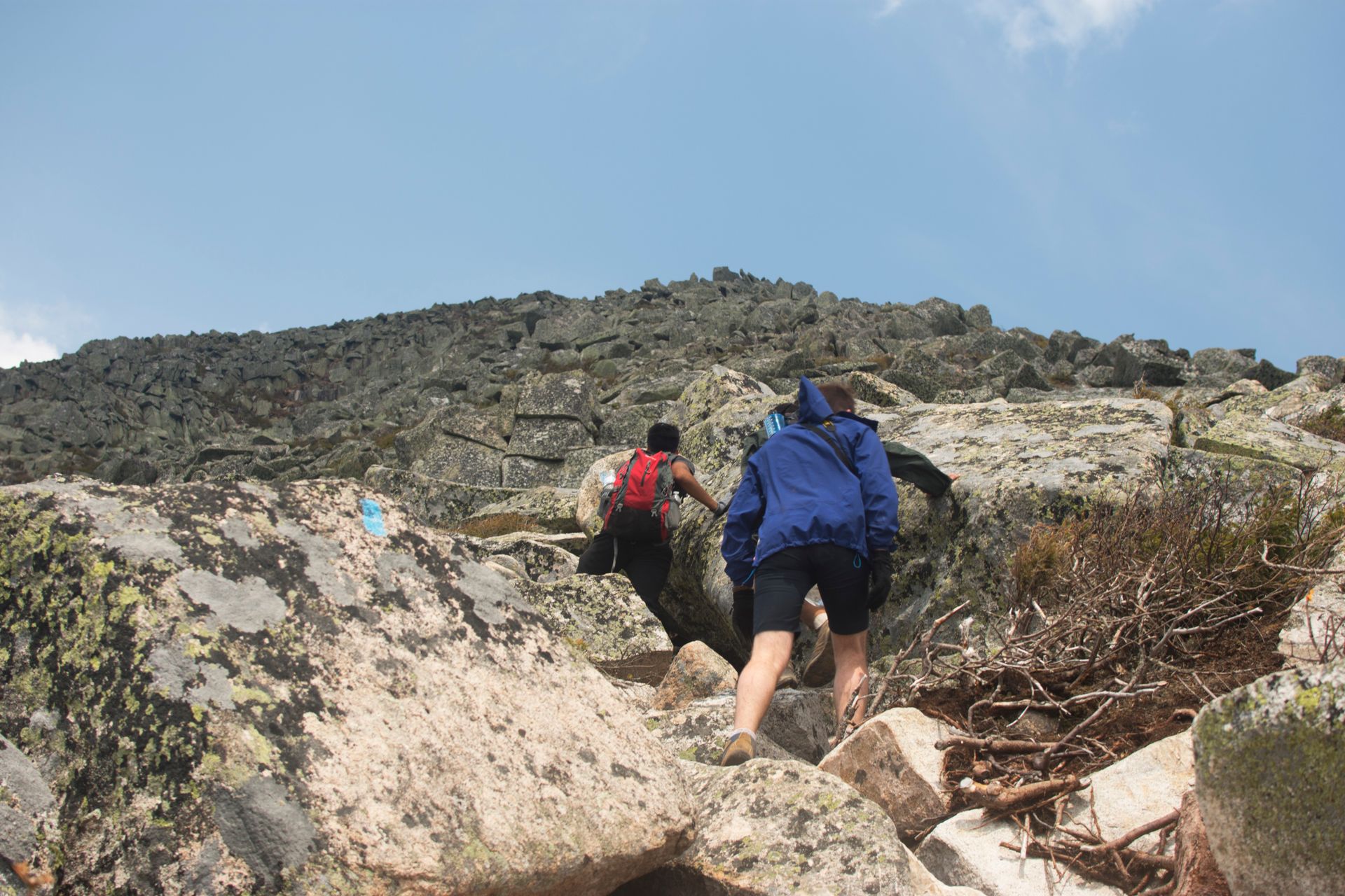
The trail was fairly easy until the tree line broke. The path went from soft dirt to tricky bouldering, but the views were spectacular.
Following the blue trail markers, we made it up the side of the mountain, pushing the miles, excited to reach the top. It was fun going, bouldering without large backpacks is always a joy!
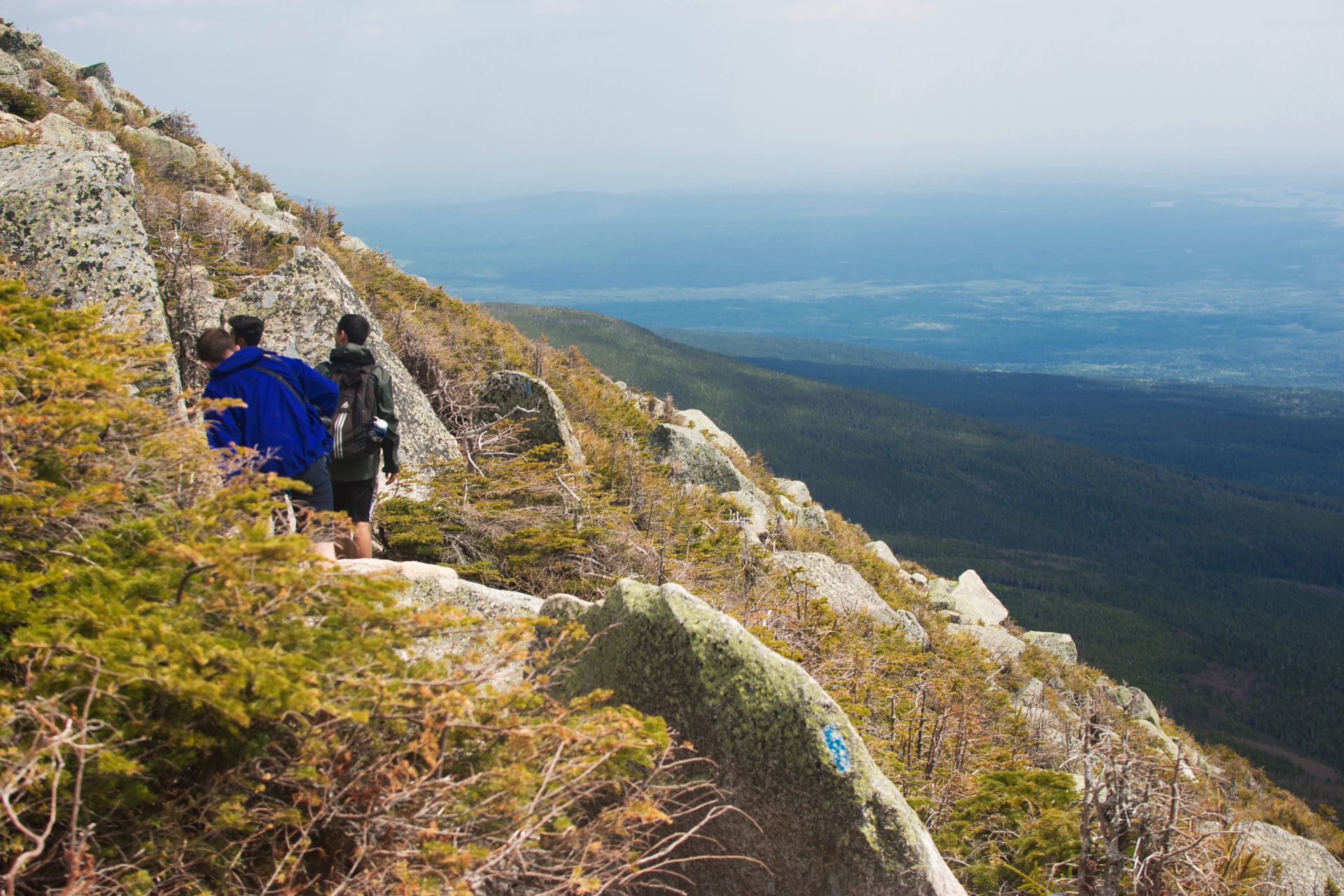
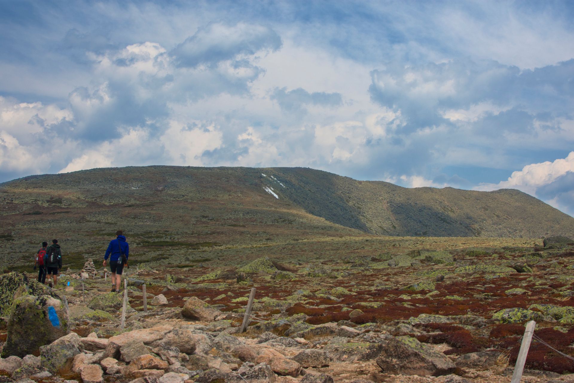
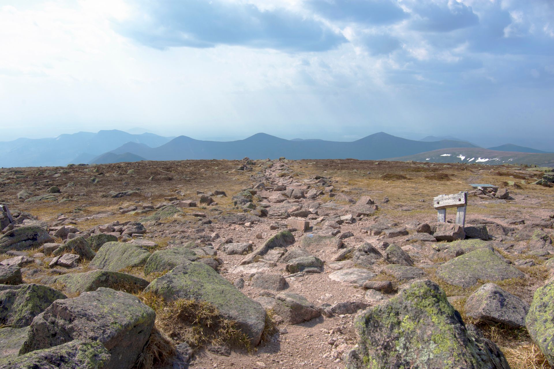
The Tablelands to the summit
Thinking we made it to the top, the ground leveled out and stretched for another 1.5 before the summit. The relatively flat space in between is a unique area called The Tablelands. The trail was outlined in rope to advise hikers to stay on the path. The Tablelands are a delicate ecosystem, and we respected the rules.
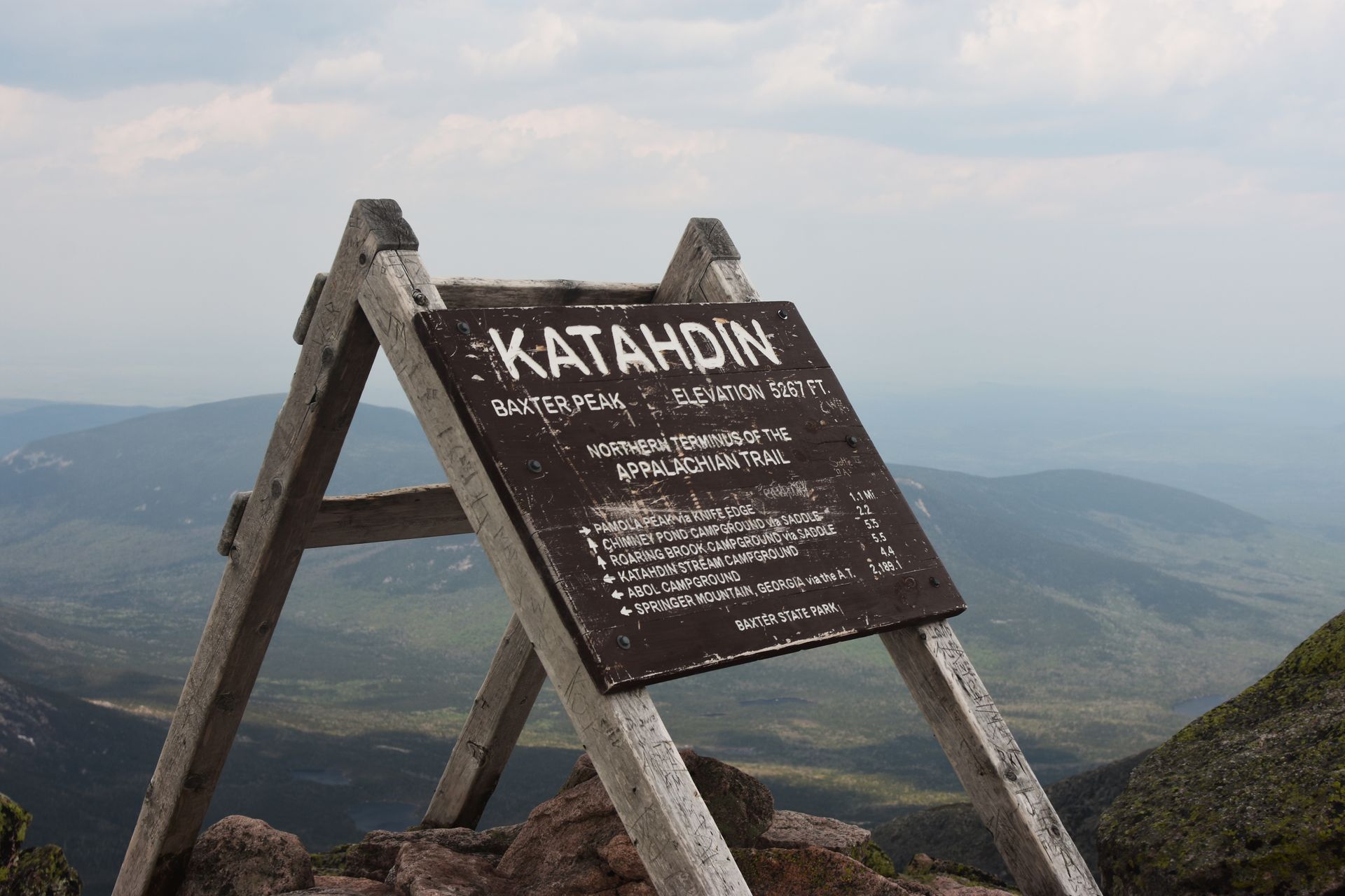
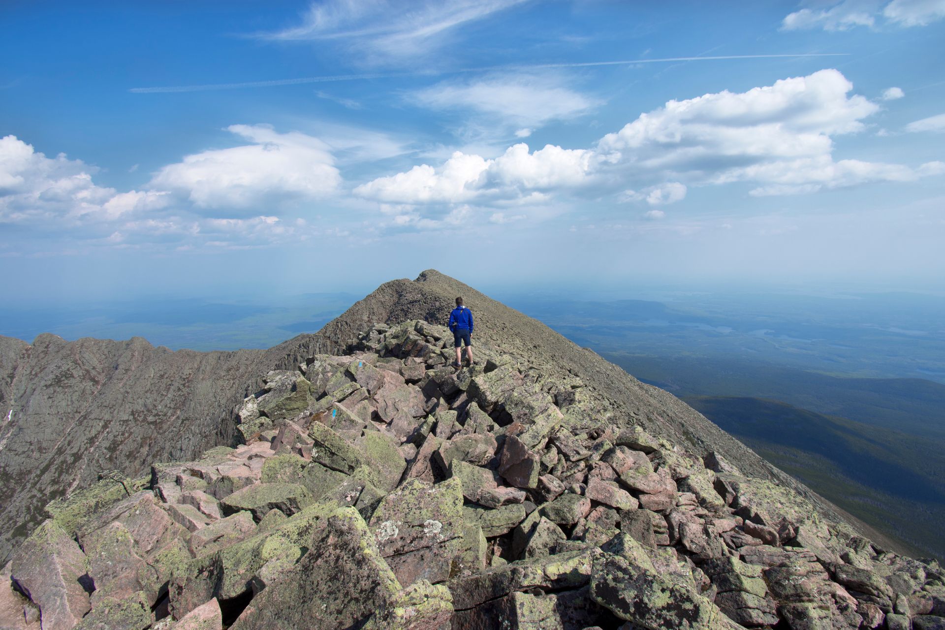
Again, after the Tablelands, the path become one last stretch of frantic bouldering. I couldn't help but feel excited when we started to see the famous white markers of the Appalachian Trail take place of the Abol Trail blue markers.
I couldn't image what the thru hikers must have felt on that last mile stretch, after stretching their legs over 2,000 miles. My brother, who had just finished 100 Mile Wilderness, was emotionally touched as well. It is almost a spiritual place, and the tabernacle, the end of the trail, the Katahdin sign was just ahead.
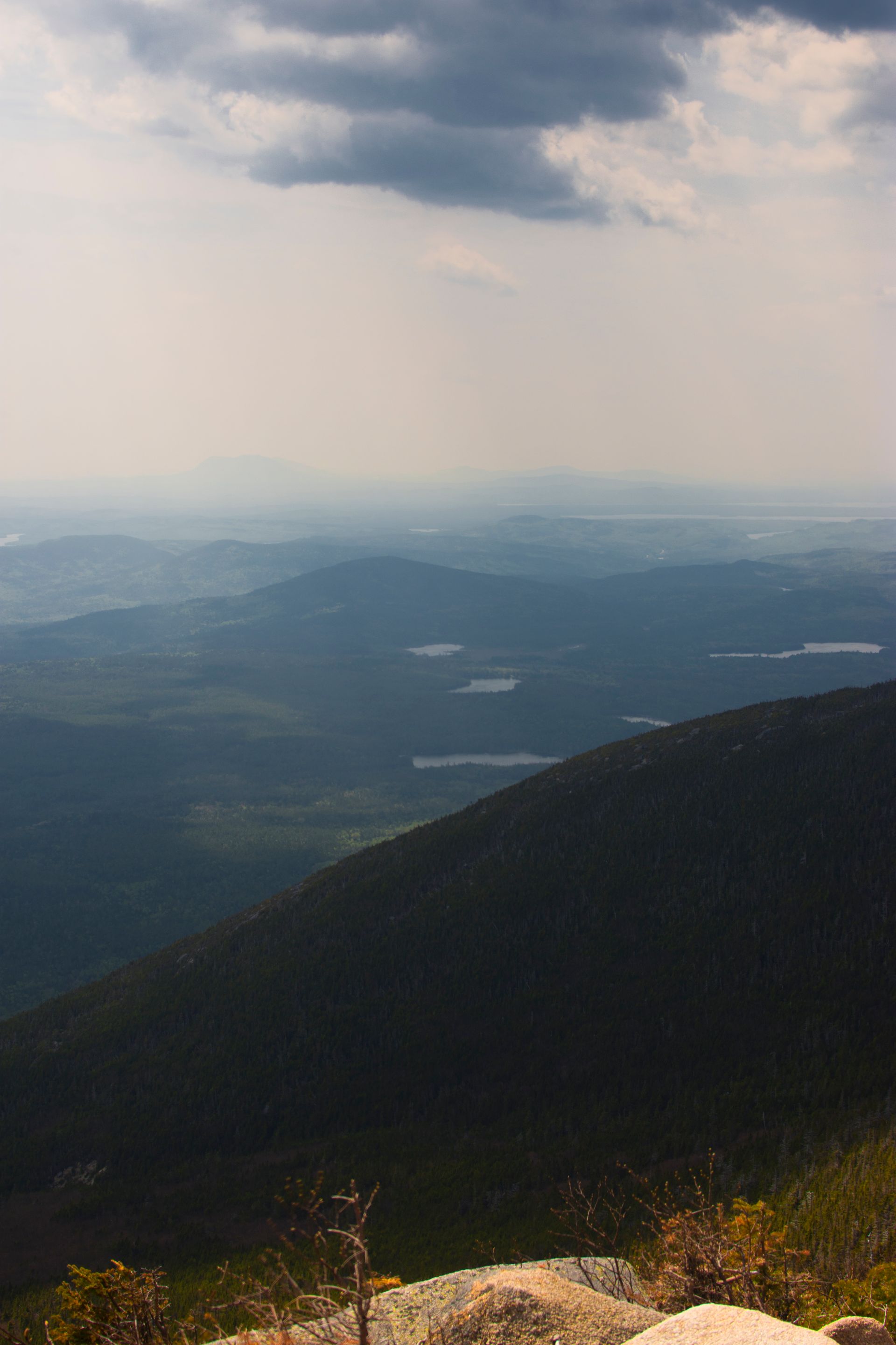
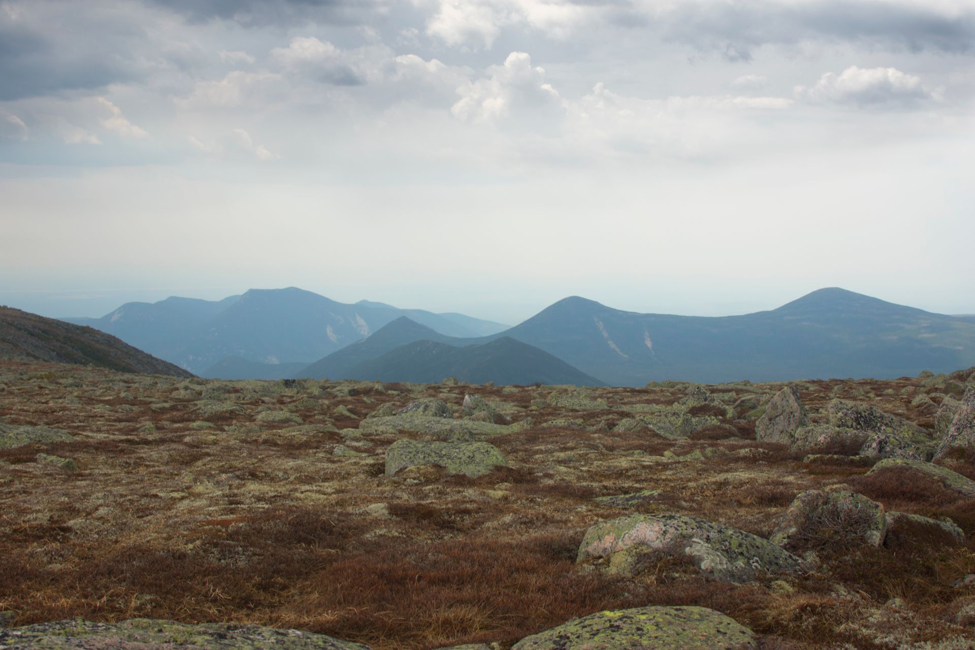
Just behind the sign was a view similar to those in Colorado or the Sierras, a beautiful alpine vista, complete with lakes and and mountain peaks all around. Unfortunately, the day was hazy, and grey, but it stole nothing from the pristine landscape that surrounded us.
We considered walking to the end of the Knife's Edge, but the wind was heavy and we weren't sure why exactly the trail was closed. The trail has claimed over 20 lives in the last twenty years, so we decided against it, and ate our lunch underneath the Katahdin sign.
I turned around to head back down the mountain, there I was faced with what could have been the start of the Appalachian Trail - a view I had been dreaming about nearly my entire life. Right there, I could have started the AT and finished all the way in Georgia. I considered it, I really did, but decided that the trail will be there next year, when I may be better situated to conquer it.
Like many others, I dream of thru hiking the AT, but it takes a truly special person to commit to a hike like that. Even finding the time, the 3-5 months it takes to walk the whole trail is difficult. But I promised myself that I will do it someday. Until then, I would just have to enjoy the hike back down the side of "The Greatest Mountain" - after all, that is what 'Katahdin' means.