Utah is no longer a flyover state.
The Plan
The plan was to start at Henry's Fork Trailhead heading south. Following Henry's Fork Trail, approximately eight miles, to Dollar Lake. There we would set up camp for the night and in the morning attempt to summit King's Peak via Gunsight Pass. The Out and Back trip totals around 25 miles, with 12.5 miles to the summit. It's possible to complete in a single day, but we want to take our time and enjoy the hike.
Ashley National Forest
With five (amazing) national parks, you would think that Utah's tallest mountain would be found in one of them. As it turns out, Utah's highest peak, King's Peak, is actually found deep in the heart of one of the states many national forests. Ashley National Forest is a massive reserve found on Utah's northern border. It's one million-plus acres holds mountains, lakes, rivers, and yes, lots of trees.
Hiking in national forests is usually much simpler, due to the lack of permits needed, and equally enjoyable to their national park counterparts. Ashley National Forest was among the nicest I've ever hiked. The trails were well maintained, the parking at the trailhead ample, and the scenes rivaled those of any national park.
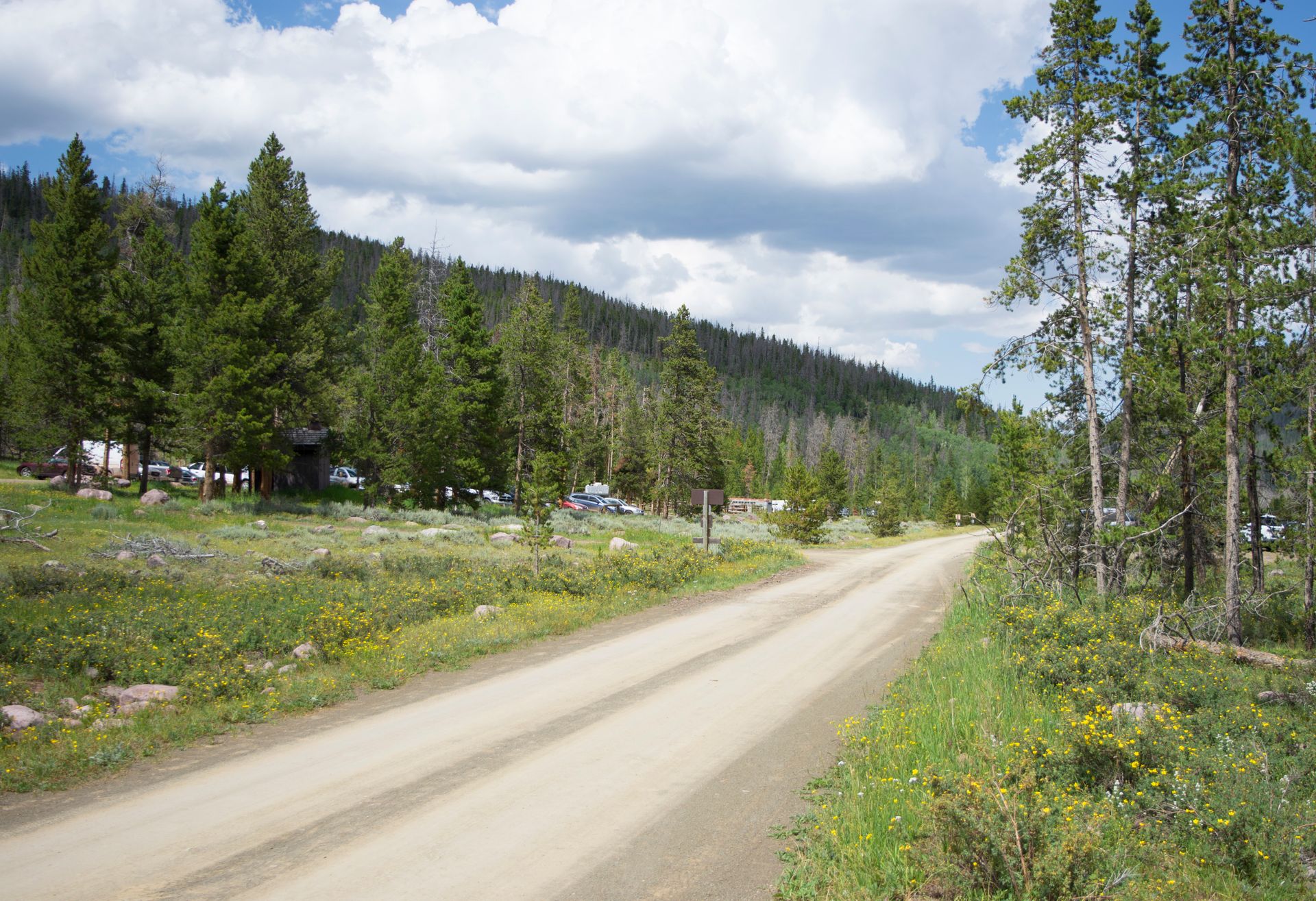
Henry's Fork Trailhead
Starting at Henry's Fork Trailhead on a Wednesday morning, we thought we would be the only ones in the parking lot. I couldn't have been more wrong. There was only one (real) parking space left in the three large designated parking areas. After we arrived a few others came in and had to get creative with their parking. This is a very popular hike, especially in August after the snows have melted. Large Boy Scout groups, family trips, and many horses and pack animals were preparing for their journey at the trailhead.
Typically, this type of activity is disheartening. You go to these remote areas to be alone. However, I understood the popularity of the trail and was hoping that most of the people were there only for day-hiking purposes. On my way to Dollar Lake - the most popular camping area at the base of Gunsight Pass - I counted well over 100 hikers. Even so, the trail and forest were large enough to hike most of the trail alone.
Henry's Fork to Dollar Lake
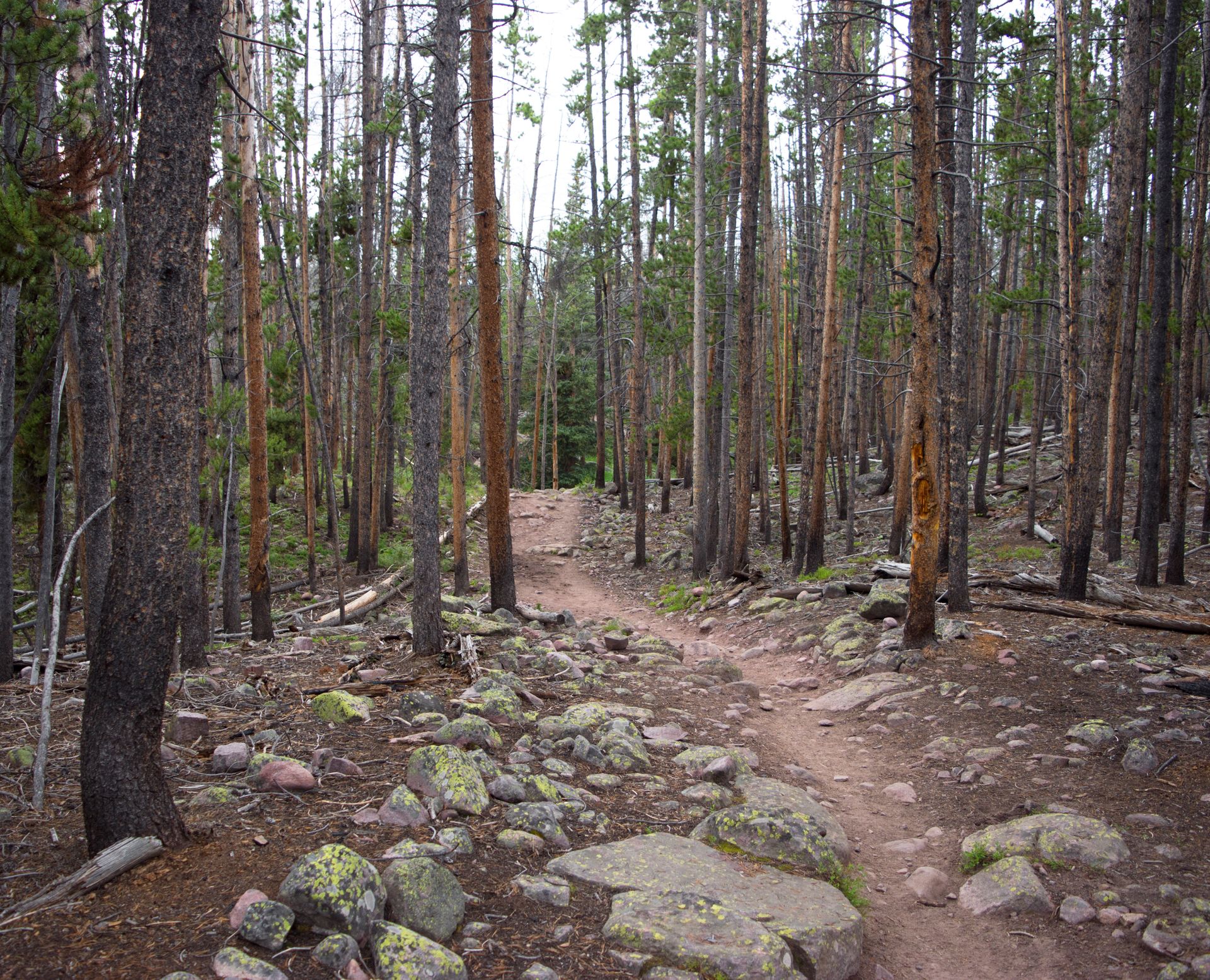
Most of the eight miles between the trailhead and the lake are hiked through semi-dense pine forests. Henry's Fork, the small, but fast-rushing, stream follows the trail for many miles. Water, in general, is abundant in the area. Two water bottles plus a filter is more than enough as long as you stop to fill up along the way.
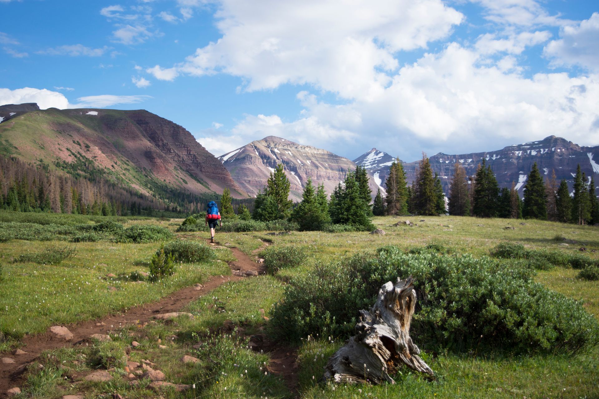
After about six miles of pleasantly flat woods trails, the forest opens to a large field. Here, we had some of our first views of the surrounding mountain range. From this point on, the trail was mostly exposed, only cutting through a few small patches of trees. This section of the trail is beautiful. Panoramic vistas of the range stretch in every direction for miles.
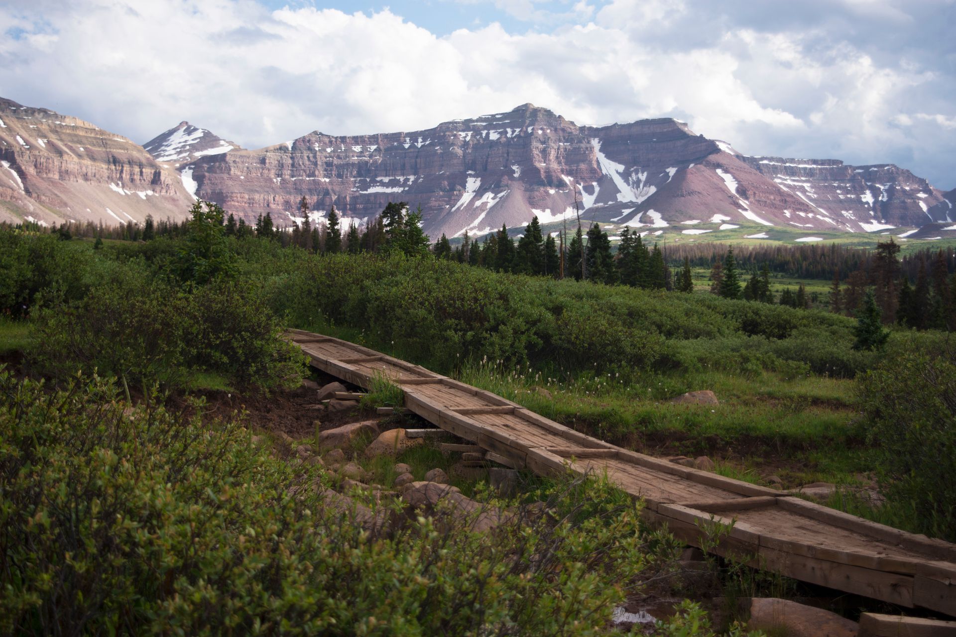
We followed the trail for another two miles. There isn't much signage, but to the left, through some trees, we saw Dollar Lake. Fires are prohibited within a quarter-mile from the lake. This is one of the few rules of the national forest, I saw several accounts of people ignoring the single rule. A firewarden was issuing warnings during the day, so keep in mind that people are watching.
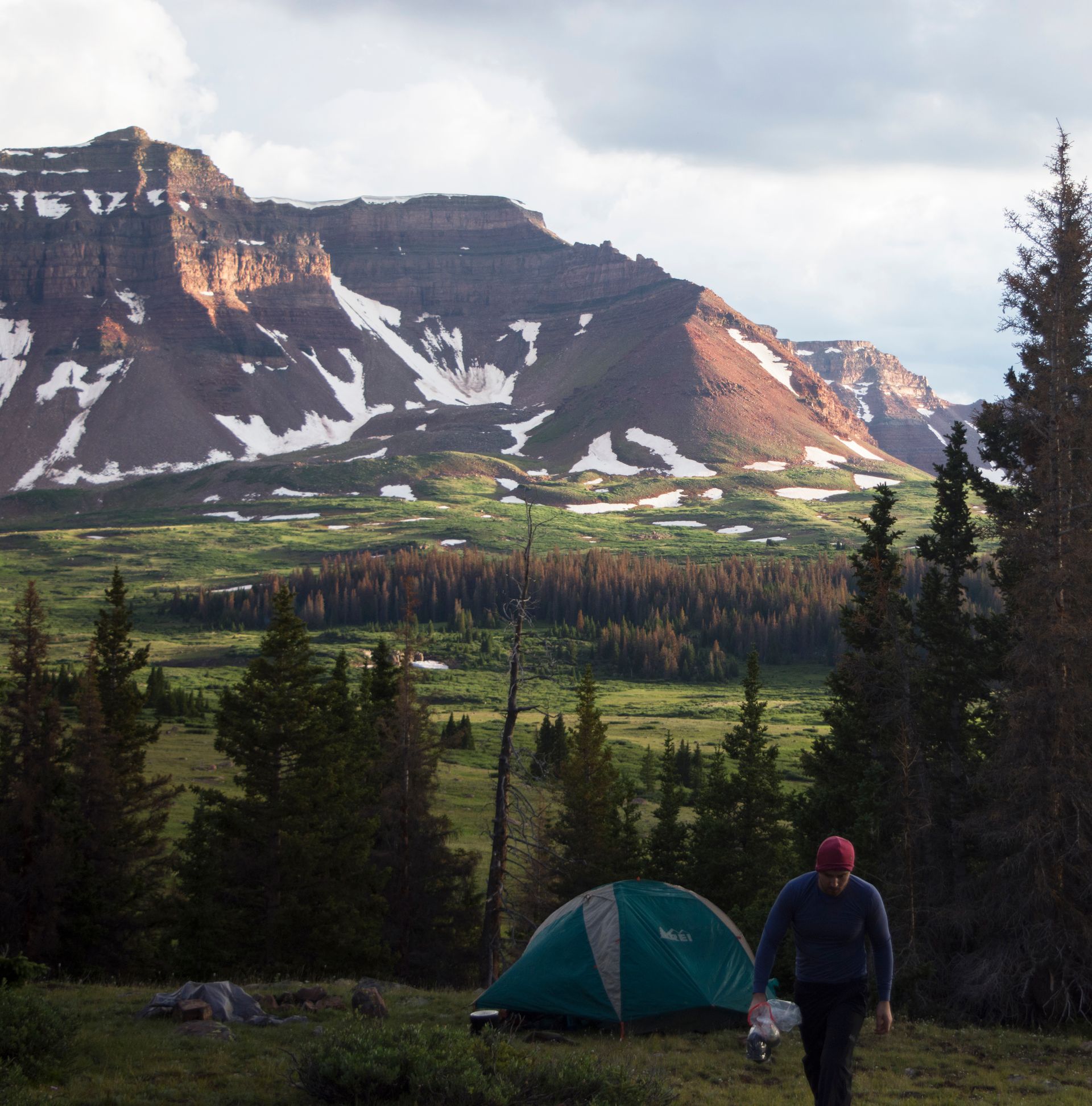
Camping around the lake is very popular, and there wasn't much space to be alone. Andy and I continued past the lake another 3/4 of a mile or so and then hiked off the path and into the foothills. There we found several places that suited primitive camping. One of these spots already had a small firepit so we didn't have to make another. It was perfect.
Dollar Lake to King's Peak
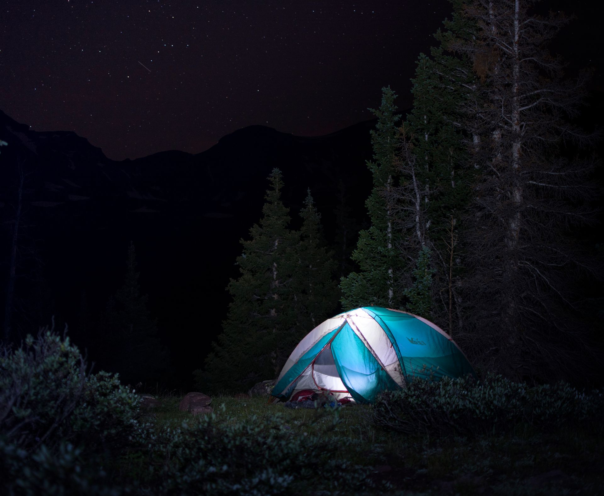
After a good rest and some amazing stars, we were ready to tackle the King. There are a few ways to reach the base of King's Peak. Most prominent, and popular, is to follow Henry's Fork through Gunsight pass and around the back of the mountains. This route offers the best-defined trails but has the most elevation. Once over the pass, the trail dips back down into the far basin before once again rising into the mountains.
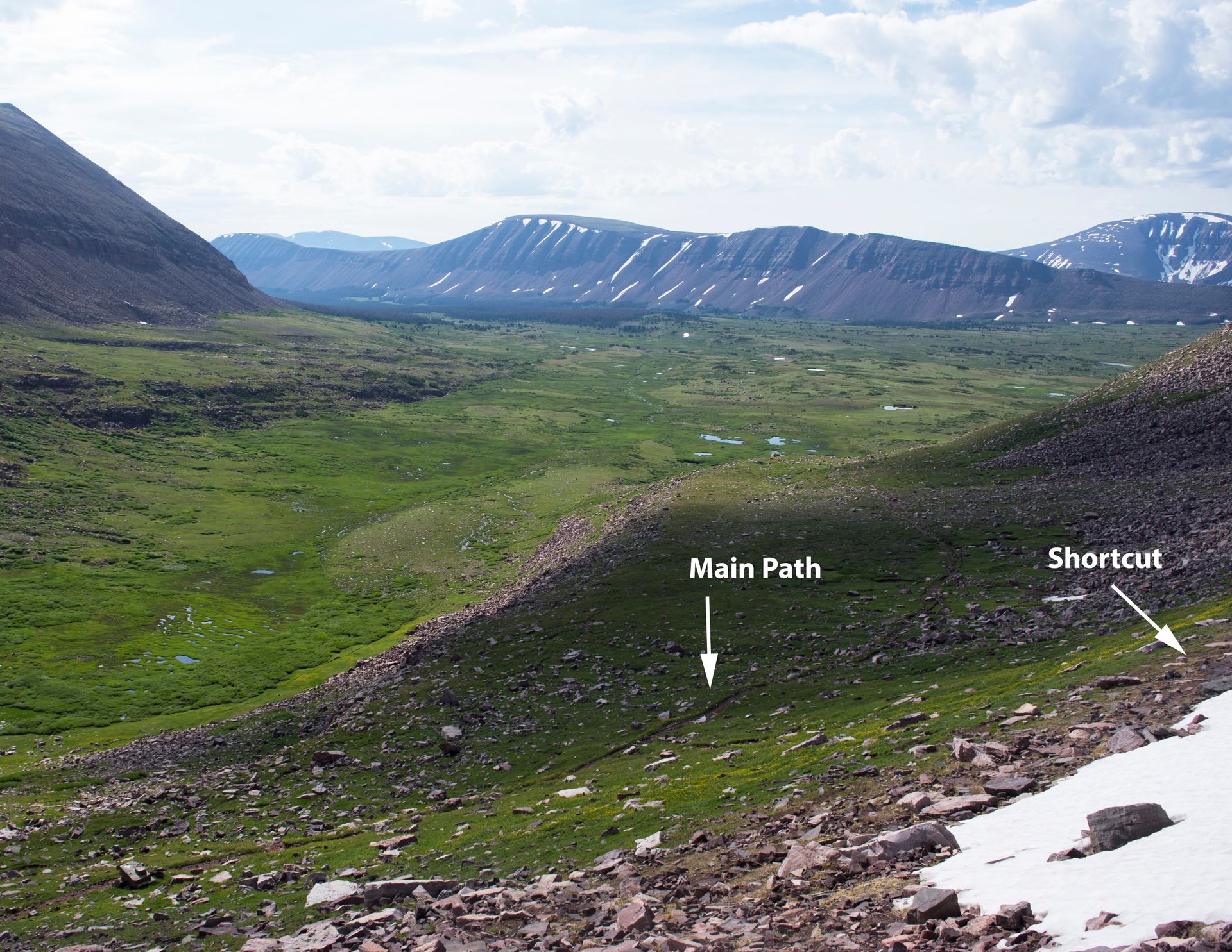
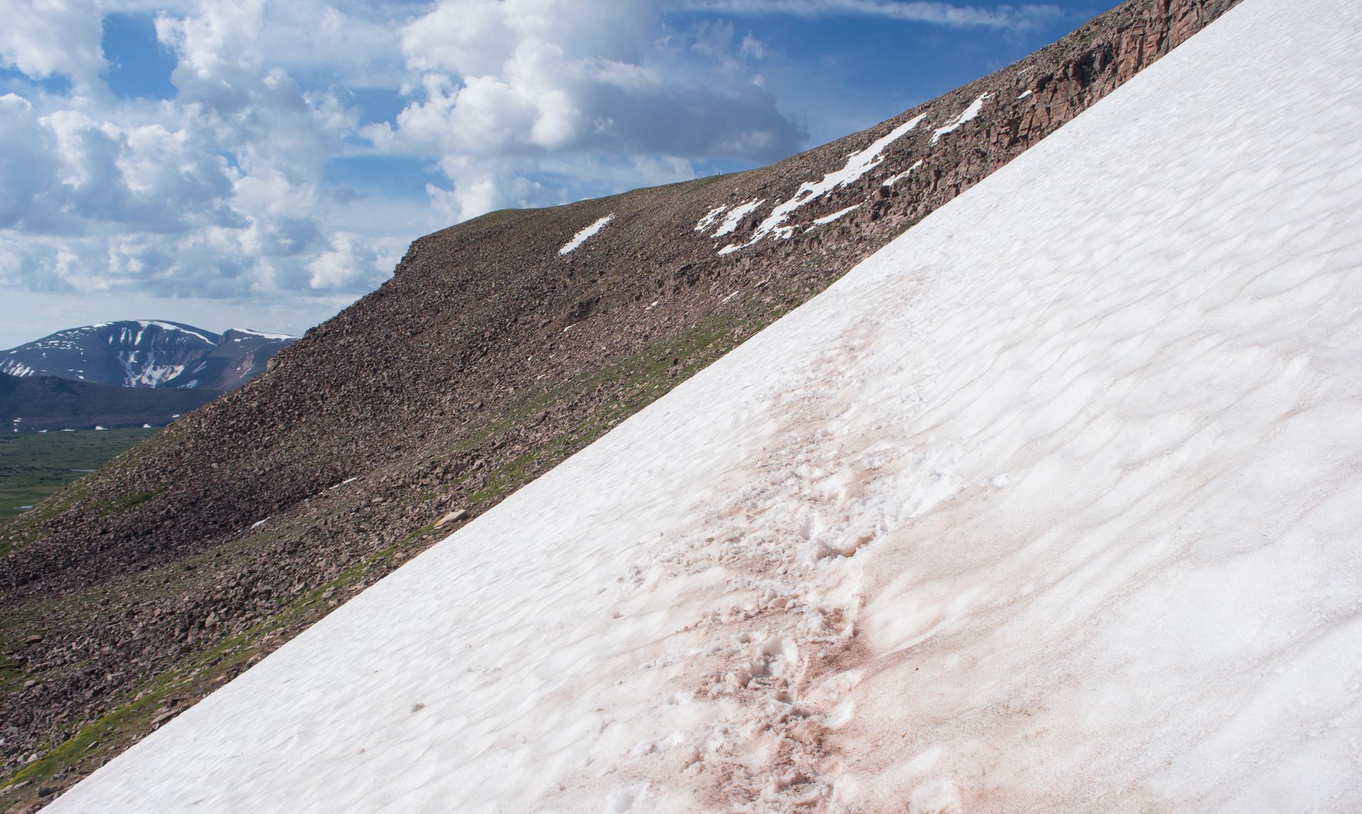
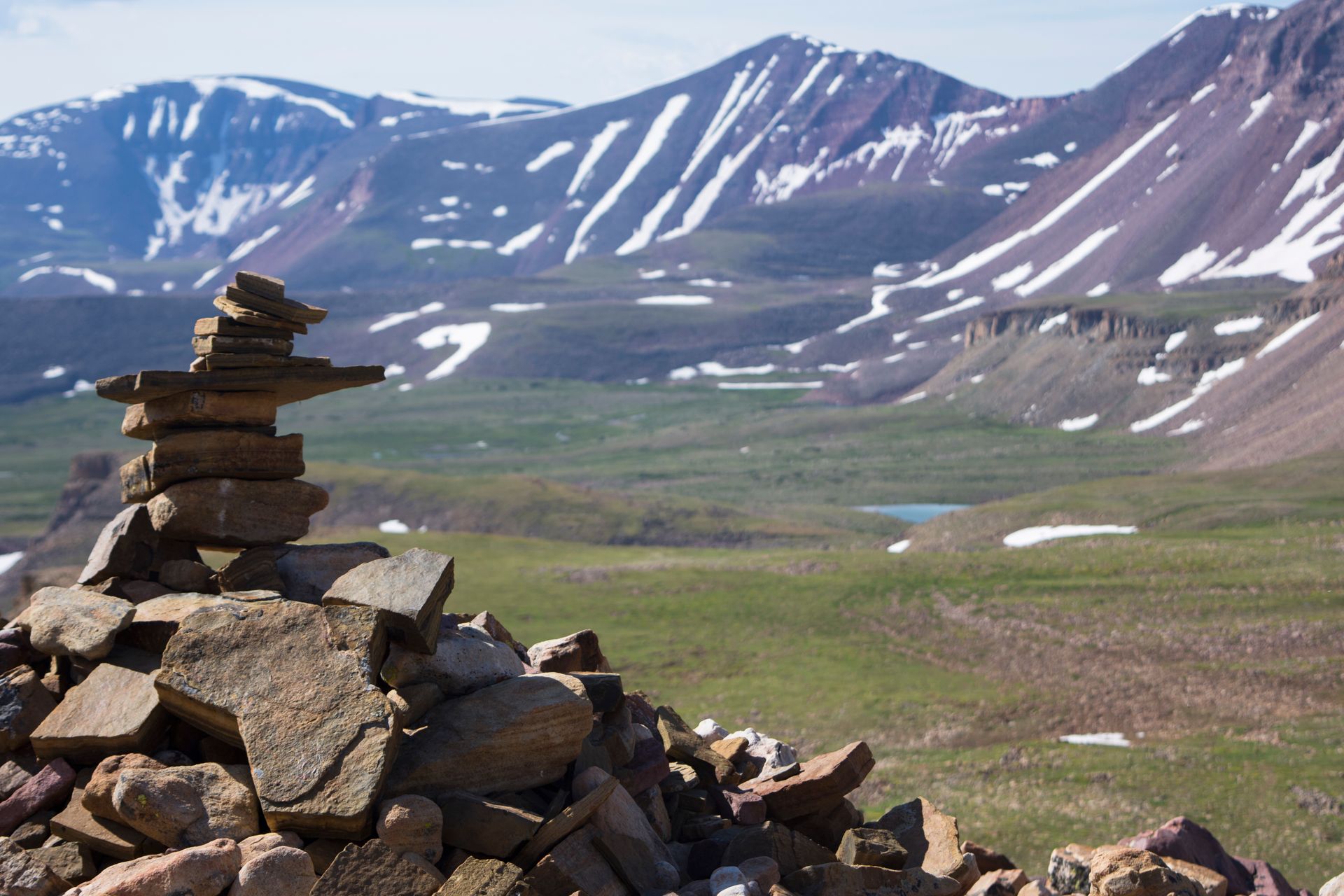
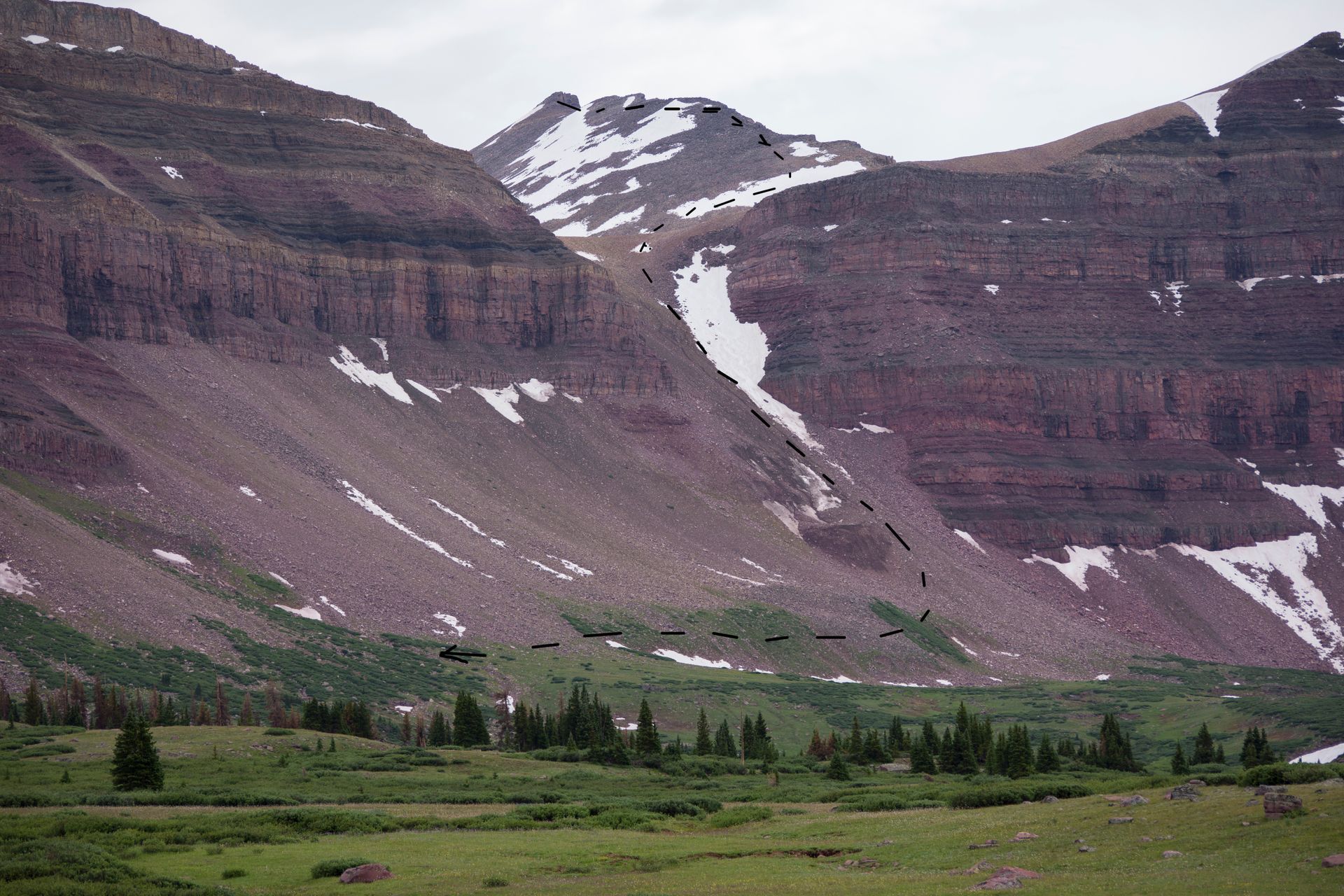
At the top of Gunsight Pass, a large cairn acts as a rest stop. Many hikers sat here deciding on the next step. One such hiker informed us of a slight shortcut that straddles the side of the mountain instead of dipping back into the basing. Hoping to shave off some miles and elevation we decided to go the make-shift route. If you go this way know that the trail is difficult to follow. Cairns are placed every few hundred yards or so, but are very easy to lose. That being said, the destination is clearly in front of you, if you're safe, you can make your own route to the foot of the mountain where the path starts up King's.
The image below shows the two paths. Notice just how far down the real trail dips into Painted Basin, the area below. Despite going off-path, it was fairly easy to follow the loosely laid cairns and paths of other hikers over the boulders.
From here, elevation begins to gain (so far most of the hike had been relatively flat). A few snow patches were still melting in the summer sun. Crampons and other snow gear were entirely unnecessary for the hike.
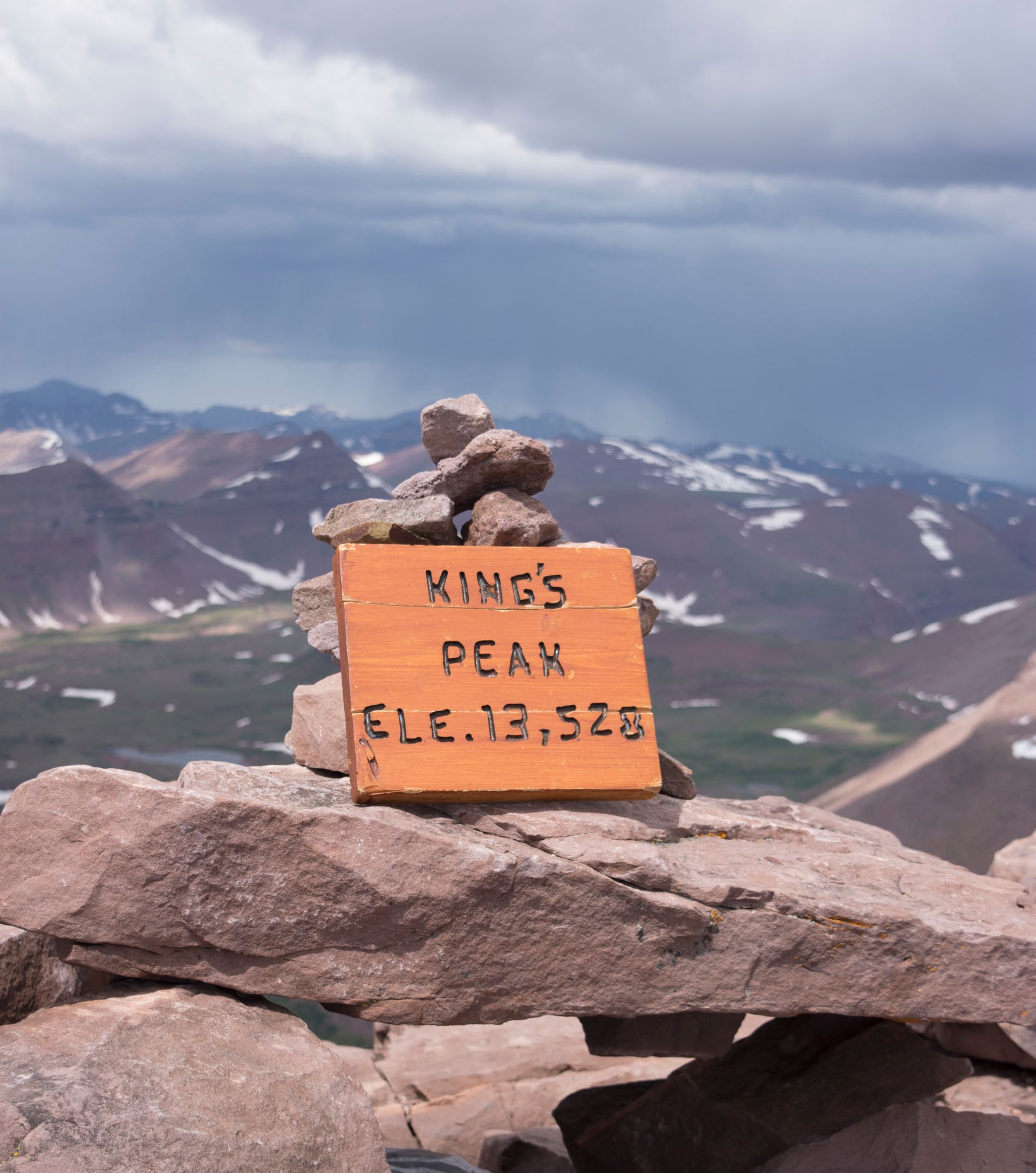
After following the cairns, we cut across a field of boulders and eventually met back up with the main trail at the base of King's Peak. From there, follow the now clearly visible trail up the mountain. There are a few false-summits, but keep going until you reach the very top. It was mostly scrambling, so I had to put my camera away. It was tough, and fun going.
Once we reached the top, a storm reared, and a terrible flash of lightning lit the sky just beyond the peak. Being 13,500 feet on the top of a mountain is never a good place for a storm. So we quickly took a summit picture and headed back down.
We were only able to appreciate the view for a few minutes, before winds, rain, and lightning threatened to fall. We still had a long way down to go.
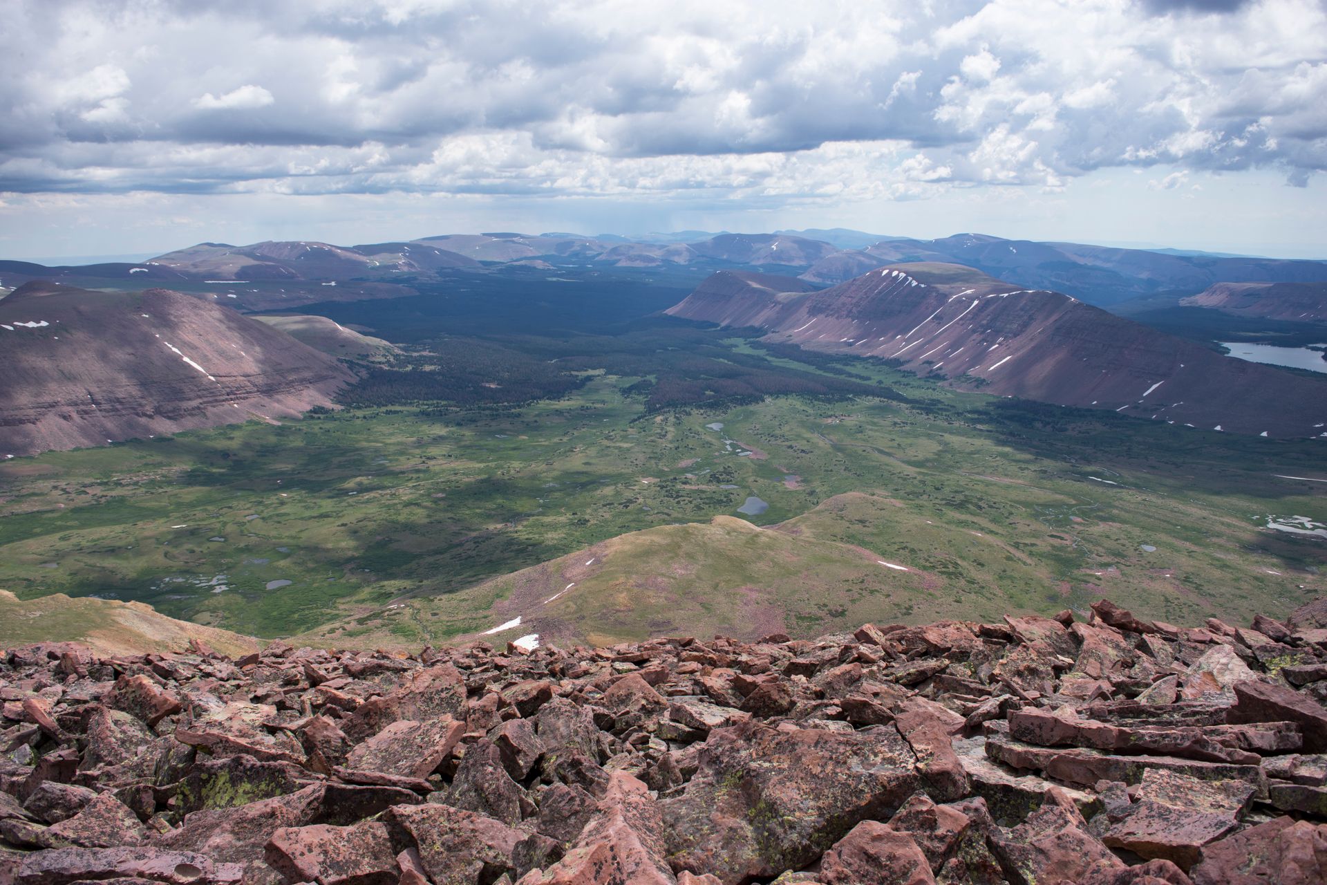
We hurried down the mountain, passing many who were still determined to make the summit, storm or not. The sky, however, looked bad, and I didn't want to risk being so exposed. As we reached the base of the mountain, we had another decision. There was a very large, very steep pass, that would have been impossible to ascend without gear, but doable to descend. With the weather getting worse, we decided to take yet another shortcut down the mountain, this time cutting off looping back around to Gunsight Pass.
We slipped and skidded down most of the pass. My boots were entirely full of stones and pebbles by the time we reached the bottom. It was slightly terrifying coming down such a steep slope, but the rains, winds, and lightning, were equally intimidating. We found ourselves about a mile from the trail, well past Gunsight Pass. Our shortcut shaved probably two to three miles of hiking around the base of the mountain.
As soon as we were safely down, it hailed and poured. I was thankful we weren't on the mountain for the storm. After hiding away for about half an hour, the rains subsided, and the sun once again shone. We walked all the way back to the trailhead without another drop of rain falling. My watch showed 19 miles hiked from out campsite, up to the summit, down the pass, and back to the campsite. A full day.
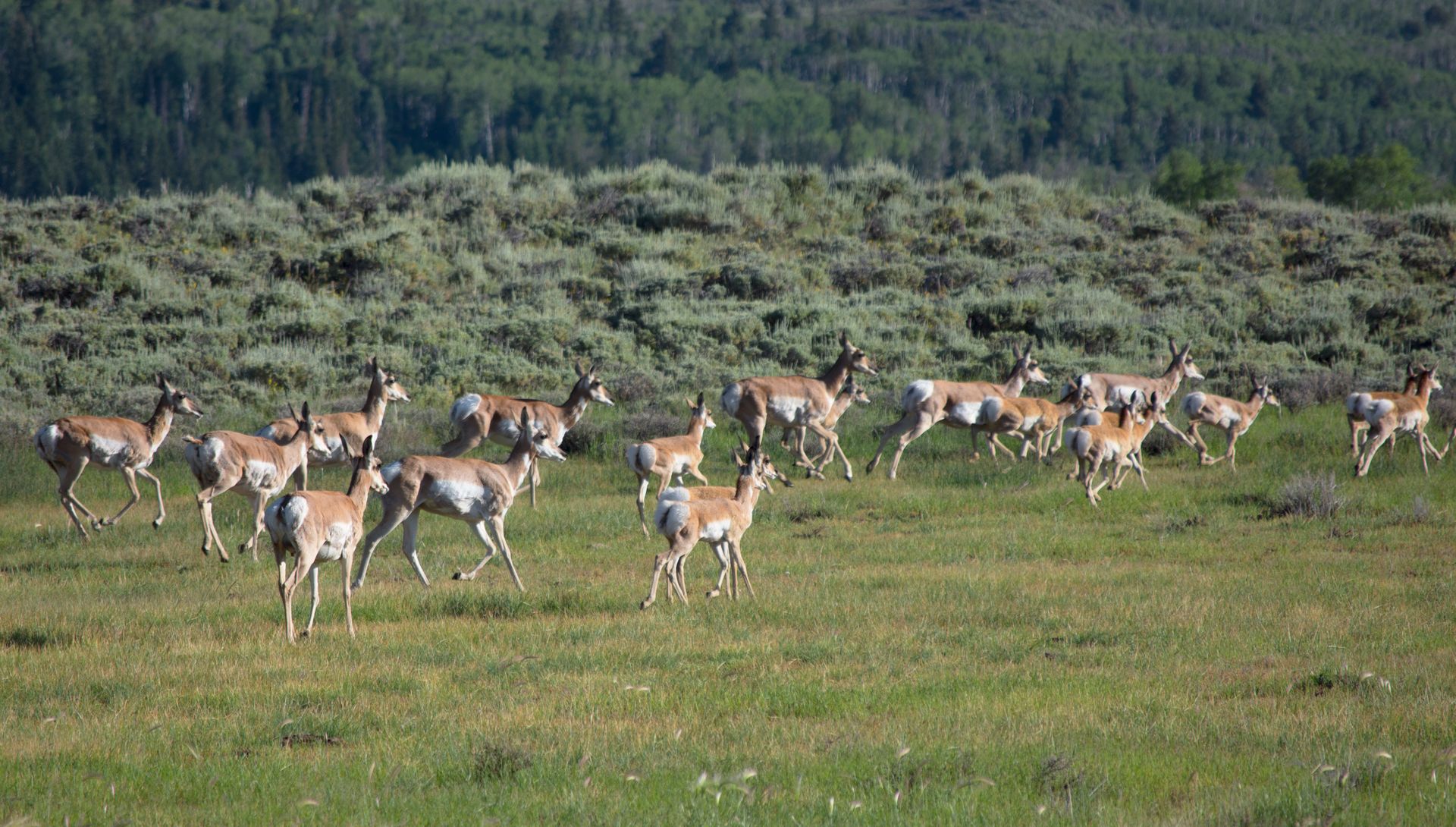
On the way out, we spotted a large group of deer. Many animals were about during our hike. If you are quiet you might see some for yourself.
There is much more to explore in Ashley National Forest. And if it's anything like King's Peak, a true adventure awaits.