"4 out of 5 Great Lakes Prefer Michigan."
The Plan
With my car in the shop, my friend Dave (a Michigan native) and I had a few days to explore the Upper Peninsula. We wanted to see it all- We managed to visit Kitch-iti-Kipi, Tahquamenon Falls, and the town of Munising. The highlight of the trip for me was the stunning Picture Rocks National Lakeshore.
Upon reaching the Superior shoreline, we began at the Chapel Rock parking lot and walked about three miles to the coast. We then came back around the loop passing Chapel Lake and Chapel Falls.
In two days we covered a lot of ground. Going in I never once considered visiting the UP, but at the end of the short trip, I was almost glad my car broke down- It gave me an excuse and a perfect opportunity to explore a part of the country I would have skipped right by.
The Upper Peninsula
There are some select areas in the country that stand out among the rest. Not necessarily in terms of explicit natural beauty, but in the sense that you feel like you’re truly stepping in a different country—or in some cases a different world. The West Texas and West Utah deserts transport you to a remote resemblance of early America, Death Valley offers a glimpse of an unforgiving planet, and the Everglades teleport from you from Disney to a tropical wilderness. These areas in the country are rare but they offer an escape from everything familiar.
The Upper Peninsula was one of these places. Nothing, not even the names of the locations was familiar to me. The way of life is so strikingly different and independent from the rest of the nation. The landscape itself isn’t drastically different than anywhere else in the north, but when you combine massive forests, Caribbean-like coastline, and add unlimited fresh water to the mix, you get more hidden gems per acre than anywhere else in the north country.
Mackinac
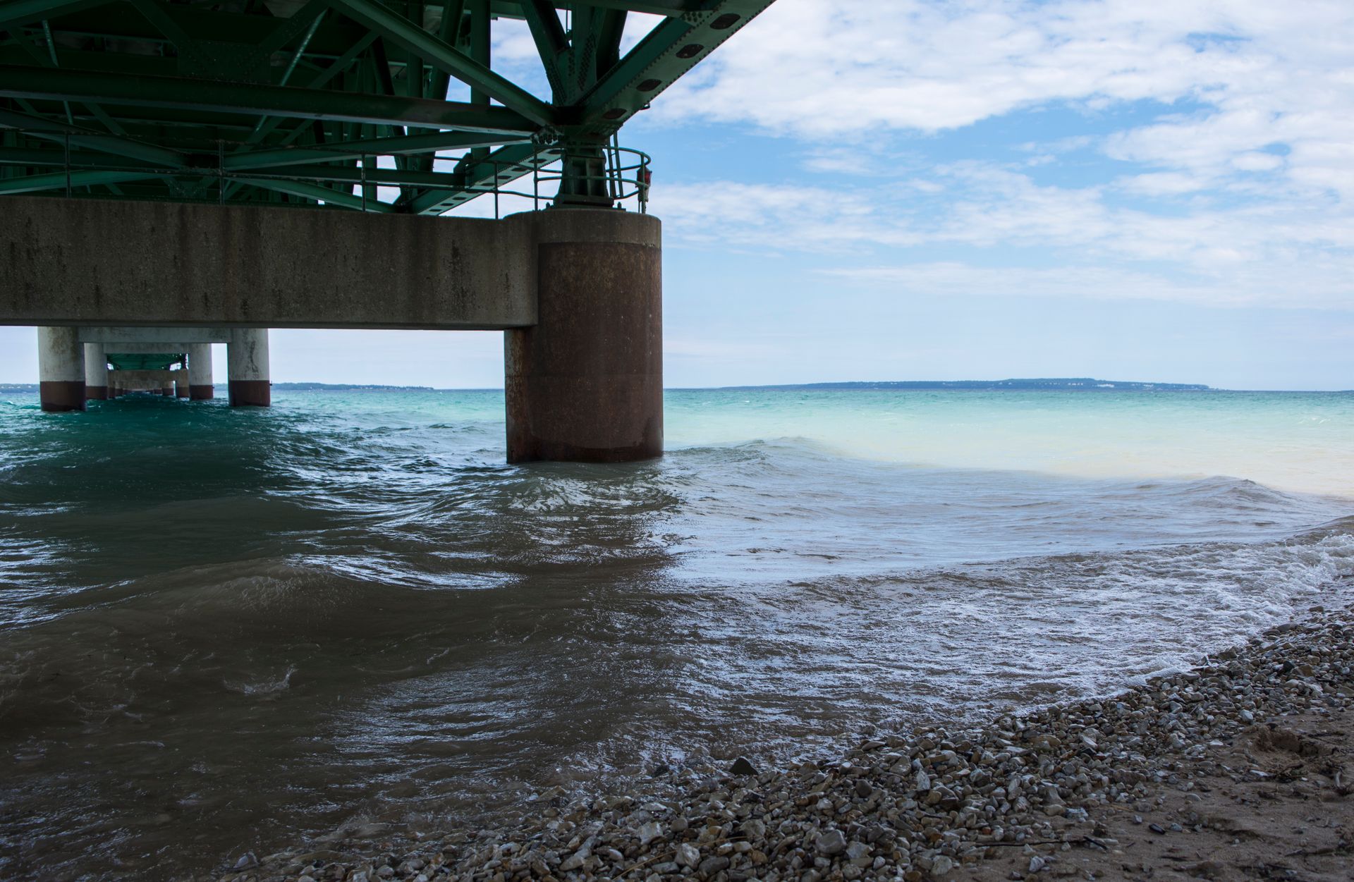
Mackinac, pronounced (MAK-in-aw), is the gateway to the Upper Peninsula. A 5-mile long bridge connects mainland Michigan to the UP across the Straits of Mackinac. The Straits connect Lake Michigan to Lake Huron - which to me sounds like it means that the two are actually one giant lake, but I’m not in charge of these things. I can’t think of anywhere else that has such an entrance. Once you cross that bridge, you’re in a different world. The land and lifestyle changes and the vastness grows.
Only 3% of Michigan’s 10 million citizens live in the UP, yet the area makes up for almost 30% of the state’s total landmass. The Yooper’s (residences of the UP) are both independent and isolated. They are a special breed of Americans, and the ones I met rarely, if ever, leave the UP.
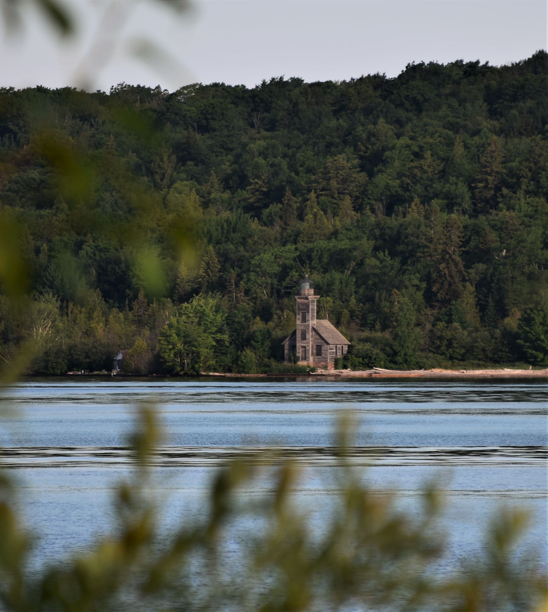
Surprisingly, there’s a lot to do in the area. Alexander Henry Park is a beautiful little shoreline rest stop, complete with a lighthouse, a visitor’s center, and if you’re willing to dish out a few bucks, a tour around an old colonial fort. But with no time, we didn’t stay long, and I was anxious to get across the bridge.
Tahquamenon Falls
After crossing Mackinac, we drove straight north and came to our first stop of our tour of the UP: Tahquamenon Falls. Growing up in the northeast, I’ve seen my fair share of waterfalls. None, however, have looked quite like these. There’s a four-mile hike between the two sets of falls- both are recommended, but the upper falls are easier to access if you have to choose only one.
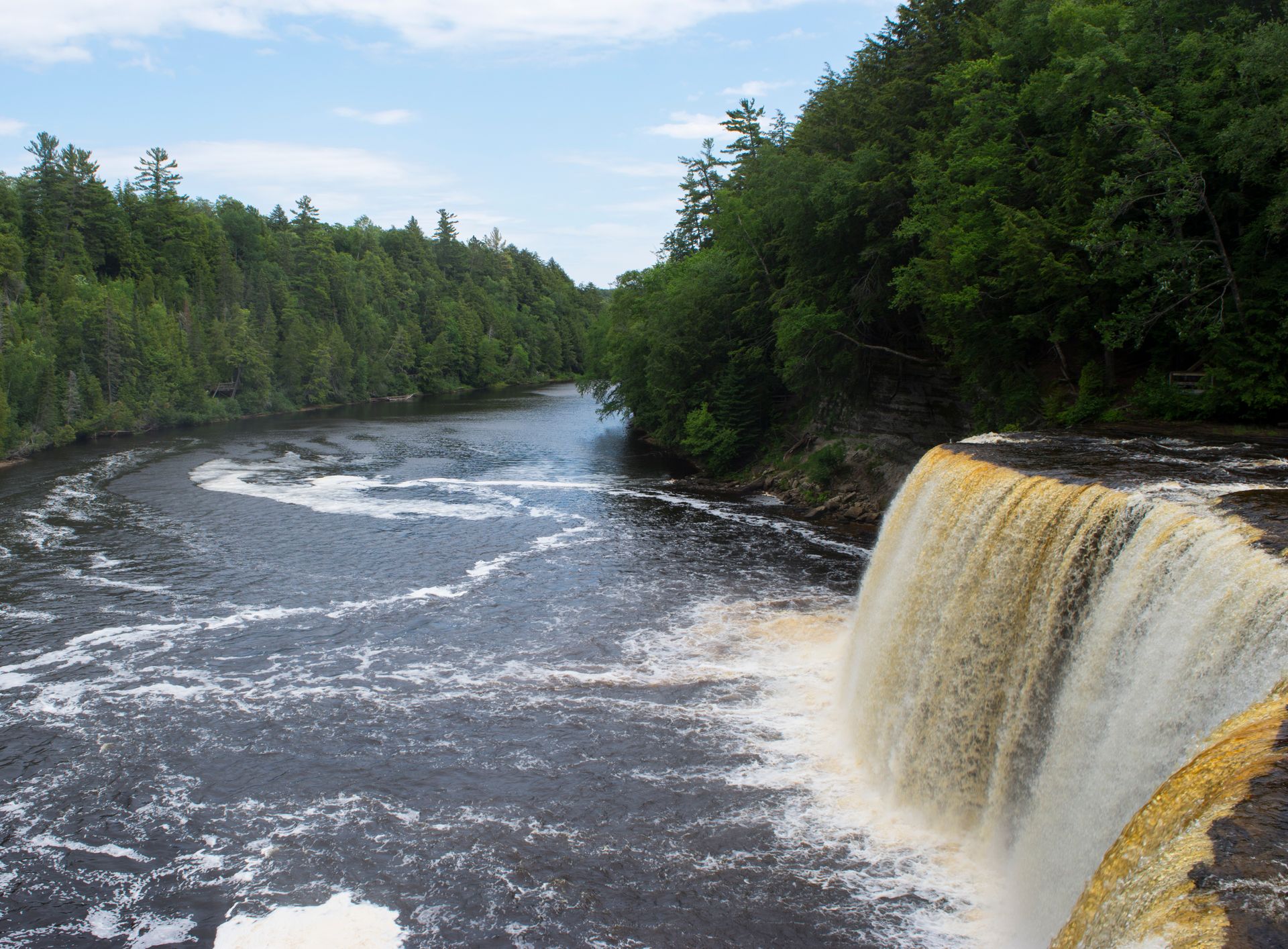
The Rootbeer Falls, as they're also known as, pump nearly 50,000 gallons of murky, brown, bubbling water over their cliffs per second. Don’t worry- the water isn’t brown from any chemical accident: they get their hue naturally from a cedar swamp further down the river. In terms of volume, the falls are the third largest east of the Mississippi, behind Niagara and Cohoes.
The entire area was amazingly well maintained. Wooden footpaths covered most of the trails, and staircases led to viewpoints along the riverbanks. I was hugely impressed with the quality of the paths.
Chapel Beach
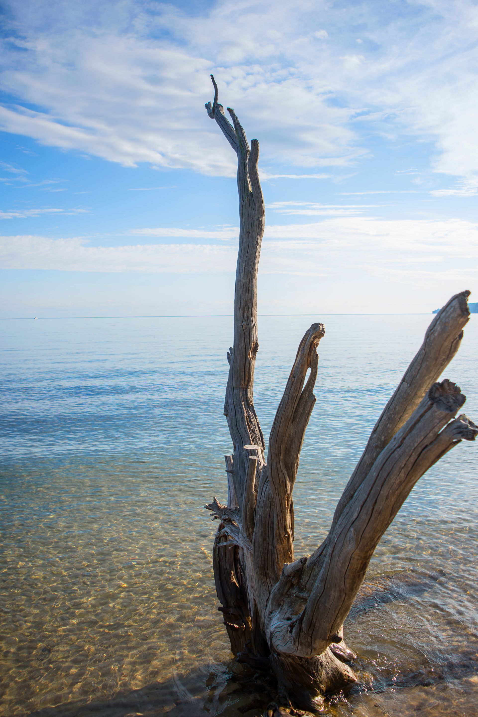
I’ll be the first to admit that I have a problem with public lands - in a good way. I’ve visited just about every type of public land around, from national parks to bird preserves. I’ve seen national seashores, but never a national lakeshore. I mean, how exciting can a lakeshore be? Lakes don’t have the driving tides, the stormy winds, and the rushing waves to carve the land as seashores do.
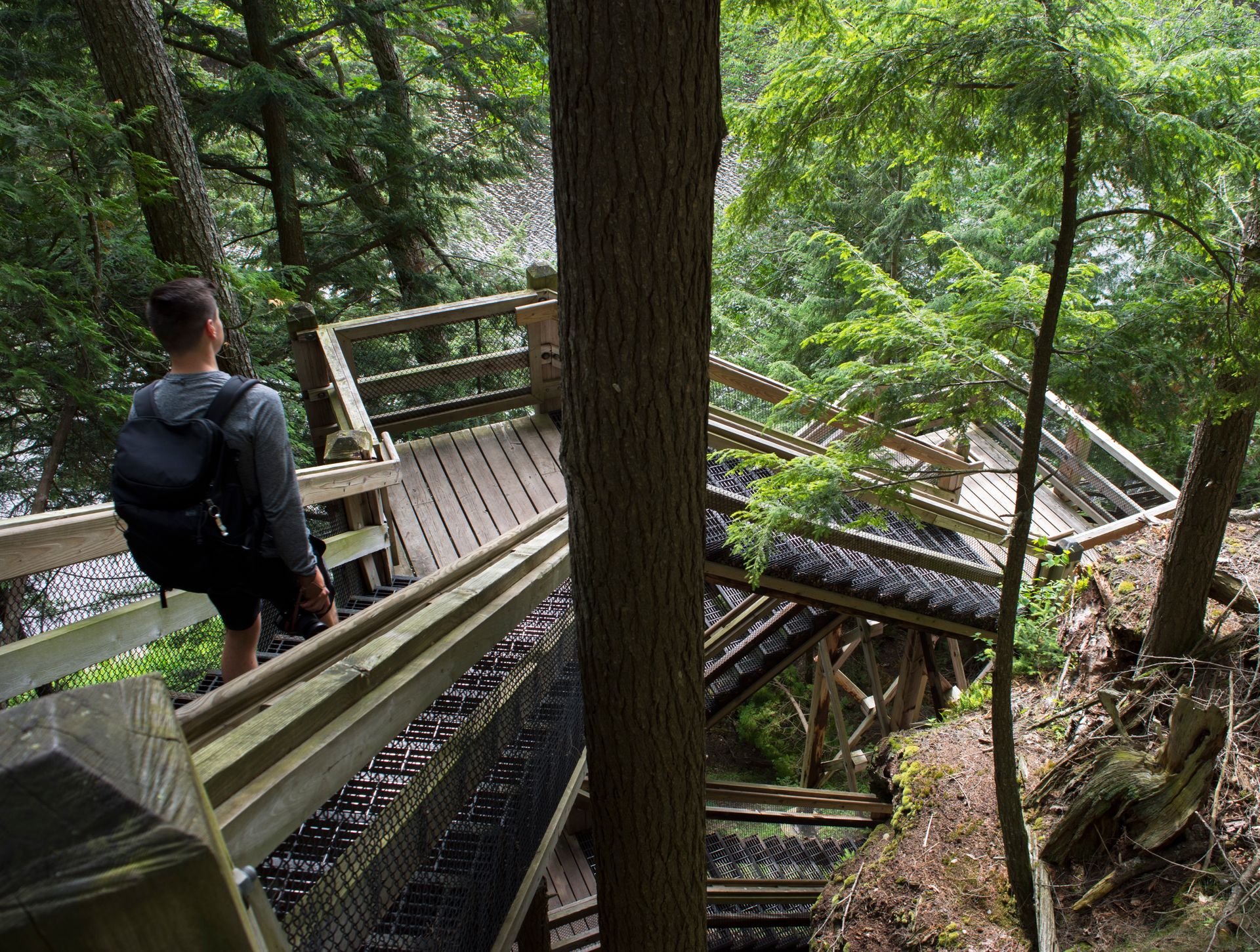
Turns out, there’s a lot of lakeshore to Lake Superior. Not being able to see it all, we decided on the semi-remote Chapel Beach. We were told by the locals that it was the beach to see. Before getting to the legendary lakeshore, you must first pass through a few miles of a beautiful forest trail. There’s no driving to this one, sorry road trippers.
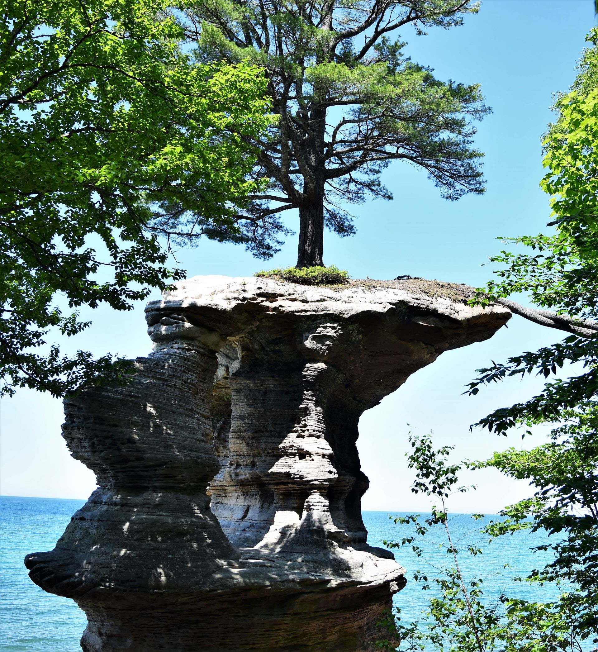
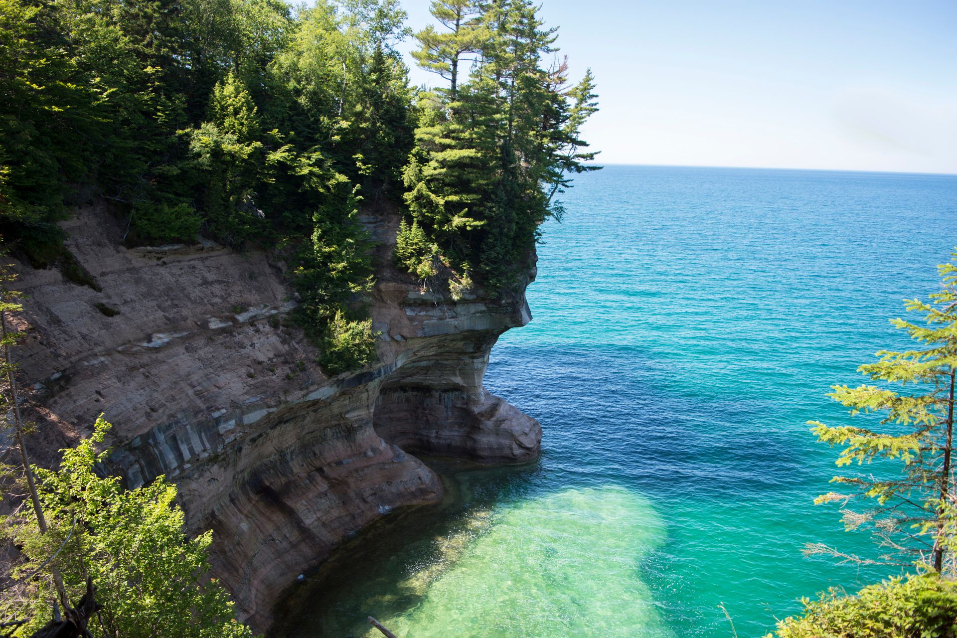
Starting from the Chapel Basin parking area, we headed along the trail past Chapel Falls, and Chapel Lake. Finally, just before reaching the shore, Chapel Rock comes into view. Now, as a current resident of Utah, I’ve seen my fair share of cool rocks- we even have a rock on our license plate! But this rock was something special. I never thought I would see the coolest rock in Michigan, of all places.
After passing Chapel Rock, you nearly trip over a few more treasures. In another instance of firsts, Chapel Falls is the only “beach” waterfall I’ve seen. Chapel Creek trickles over the beach and meets Superior’s waves.
You step over the falls and onto the sands of Chapel Beach in one motion. The Northern Michigan beach was one of the finest I have ever seen. Caribbean blue waters gently rolled up on silky smooth sands. Once in the water, the sand washed away to expose a bed of perfectly rounded stones in a stunning array of colors - from bright red to perfect white.
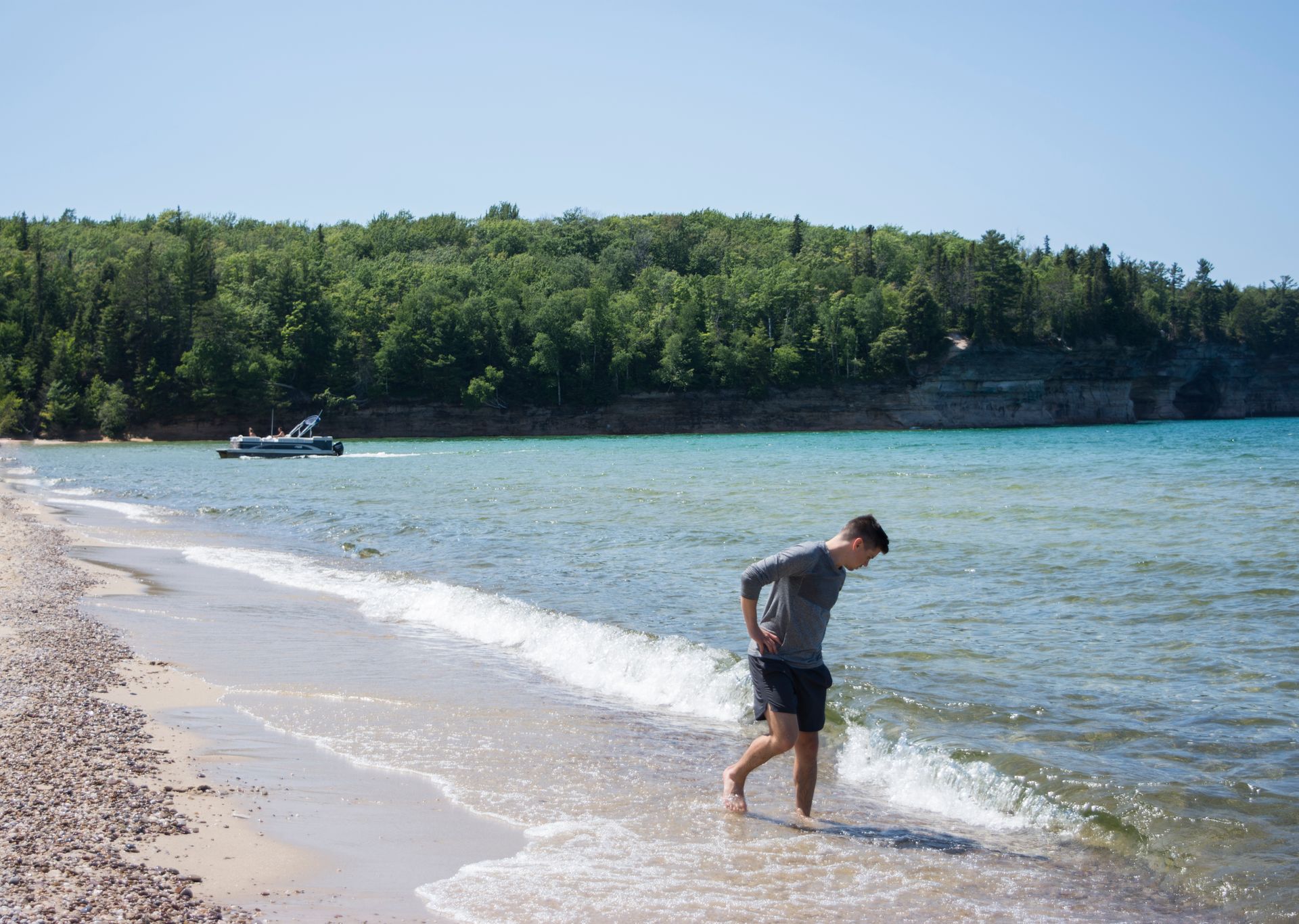
The trail looped around and back into the forest, but we took our time covering the section that was on the beach. Pontoon boats full of rowdy Yoopers parked right up on the shore, families splashed in the water, even with the shouts of pleasure, it was nice, and yet despite the people, it still felt remote.
Picture Rocks
From the beach, you can see the white cliffs of the famous Picture Rocks. Naturally, we wanted to get a closer look, so we diverged off of the trail and hopped on the Lakeshore North Country Trail which stuck close to the edge of the cliffs.
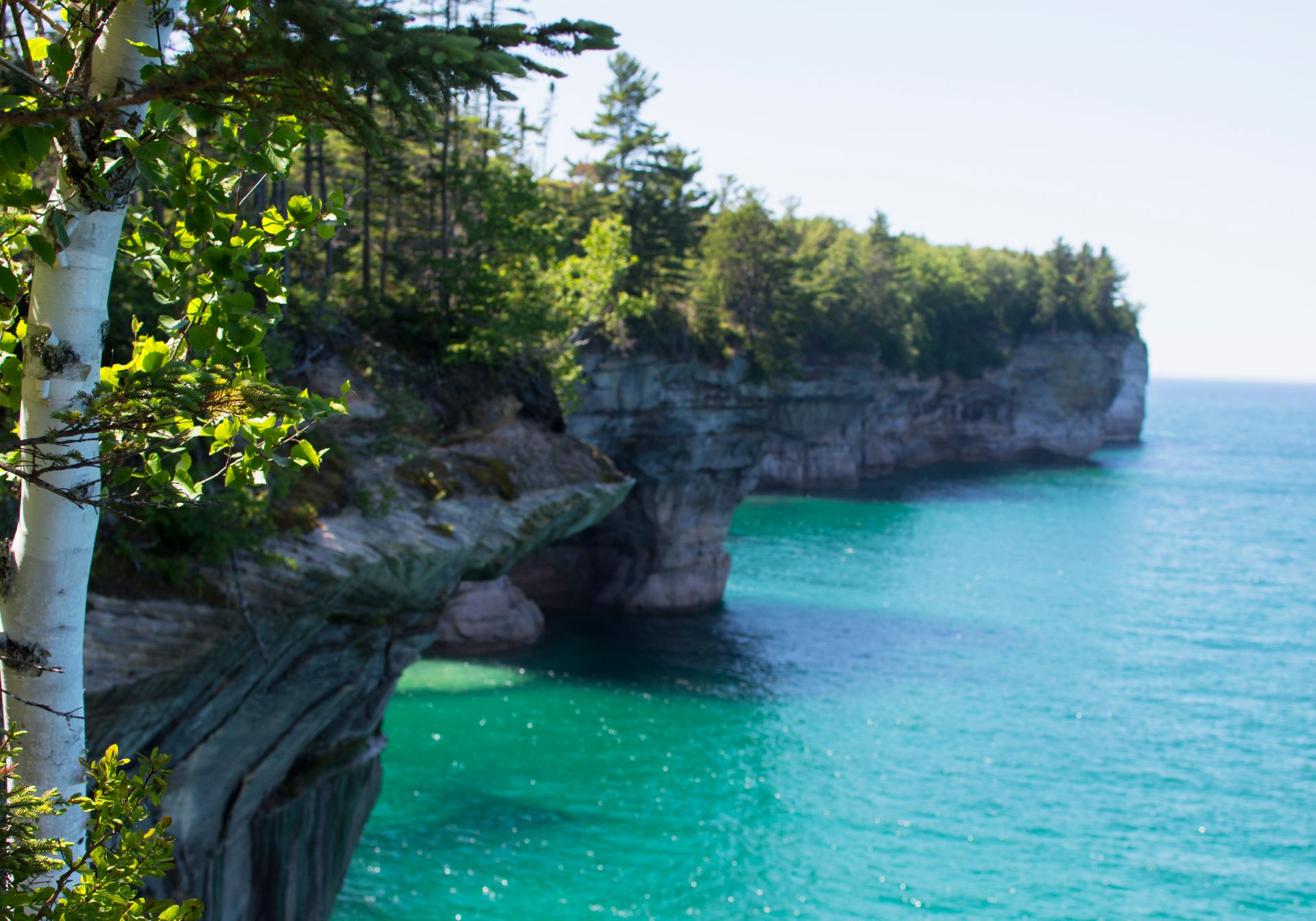
The cliffs are a spectacular sight. Ancient trees block the view of the lake until you are right at the edge. You can hear the splashes of waves nearly two-hundred feet straight down into the teal water.
We followed the trail until the light started to fade. There are campsites along the beach, but you must reserve permits. They are very strict about camping in the area. We didn't have a permit, so we couldn’t stay the night and needed to get back to the car.
Munising
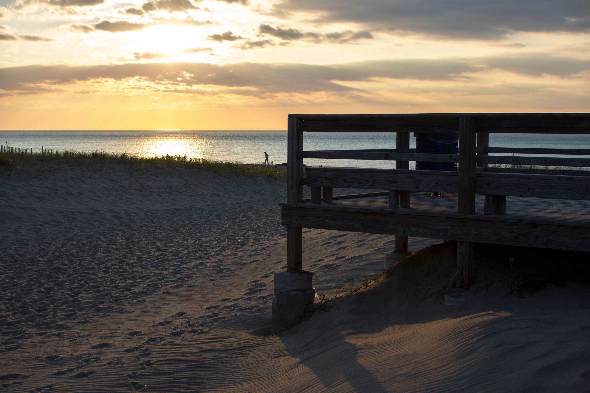
Not wanting to miss the sunset, we found a public beach in Grand Marais, a small town just northeast of the national lakeshore. As an Easterner, watching the sun set over the water is a special treat and the beach on Superior resembled those of the Outer banks.
We then drove along the shore, back past the national lake shore, to the town of Munising. It’s one of the larger towns, and went to a small brewery where we met and chatted with an elderly couple. They were born and raised in the town: Anna had never left, and Frank left once to when he was deployed to fight in Vietnam. His division happened to be the division that inspired M.A.S.H.
After a long talk, and a few beers, we needed to find a place to sleep. Luckily, there’s a massive national forest just south of the town. We waved goodbye to Superior’s waves and went inland.
Kitch-iti-kipi
On the way back, we had one last stop to make. Dave must have told me a thousand times before I was able to repeat back, with confidence, the place we were headed. Commonly known as The Big Spring, Kitch-iti-kipi is Michigan's largest natural freshwater spring. A strikingly clear, 300ft pool of the finest, freshest water bubbles up from an underground source. The spring is highly protected, allowing the fish grow to tremendous sizes.
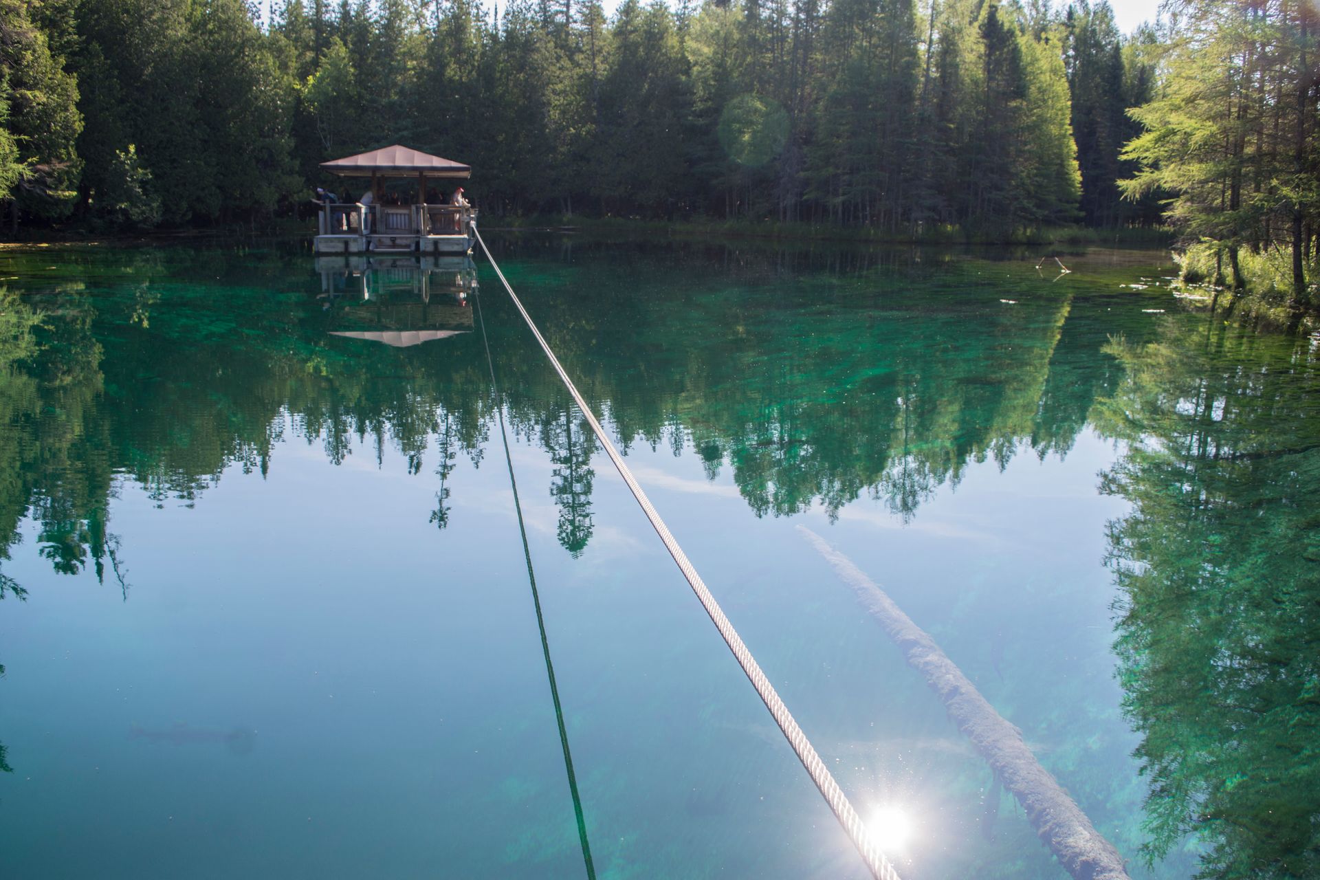
Kitch-iti-kipi was one of the smallest, yet most unique parks I’ve ever visited. A hand-pulled wooden raft floats on the glassy water. Passengers get on, get tugged across the pond, then get off. As far as attractions go, it wasn't exactly thrilling, but the natural wonder was more than worth the drive out.
Only having two days, we managed to see many of the UP's natural wonders, but we also missed a significant amount. I wish I could have hiked along the shore on an extended trip, or explored the interesting sea-like towns along the freshwater coast. But those adventures will have to wait for another day. I will definitely be going back.