"Mountains have a way of dealing with overconfidence."
The East
There is no doubt that Western United States holds almost all the records when it comes to adventurous adjectives. The West has the tallest, the highest, the largest, and the driest. It has the hottest of the hots, and the freezing colds. There are endless snow capped peaks, forests, caves, deserts, and hills. They say beauty is in the eye of the beholder, but if the beholder argues for a more beautiful area, they need to get their eye checked.
That being said, Eastern United States also holds its own surprises. More populated and less grand, you might think it's impossible to find a comparison between the two seemingly different worlds, but they do exist. Possibly the greatest example being the Presidential Mountain Range in Eastern New Hampshire.
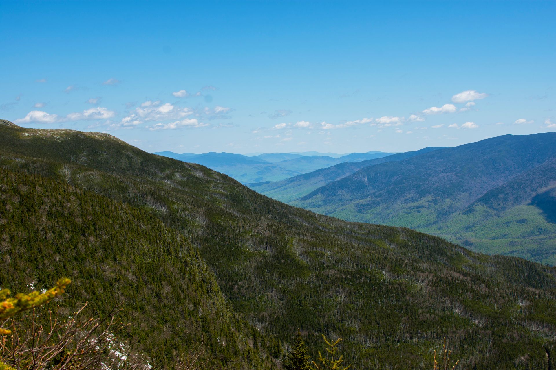
Driving into the White Mountains of New Hampshire, the landscape almost makes you think you made a wrong turn and somehow ended up in central Colorado. Bald peaks, alpine forests, snow on snow on the slopes until late May, and the general atmosphere sent me back to the West.
Pinkham Notch Visitor's Center to Tuckerman's Ravine Trail
Unlike any other mountain, there are various methods to getting to the top of Mt. Washington. Getting to the other methods later, the route we took started out of the AMC's Pinkham Notch Visitor's center. Because it was so early in the season (beginning of May) there was only one route to the summit due to snow conditions. It was Tuckerman's Ravine Trail to Lion's Head Trail. The total length was around 8.5 miles round trip and about a 4,300-foot elevation gain. That is nearly 1,000 feet per miles going up the trail, I found it to be enjoyably challenging - expecting much easier.
Before you can even start the trail, you are reminded of the dangers of Mt. Washington by a sign near the trailhead. It reads; "The area ahead has the worst weather in America. Many have died there from exposure, even in the summer. Turn back now if the weather is bad." - some way to start a hike! The weather on Mt. Washington is notoriously bad, and even brags about one adjective the West does not have, the windiest, so be careful on the trail and make sure you wait for good, clear, skies.
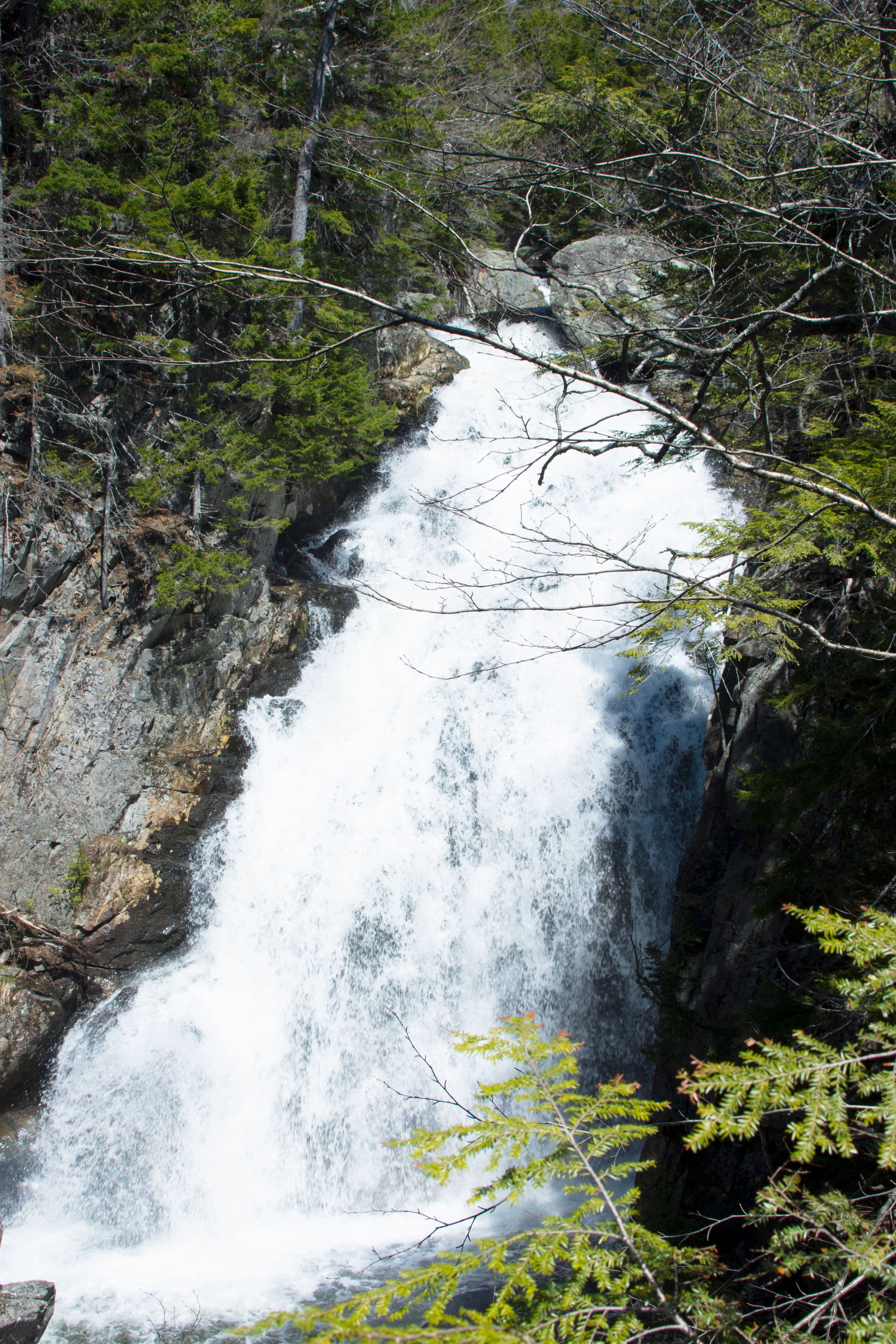
The trail started simply with a large rock path leading straight into the forest. Within minutes you hike over rushing white waters on well-made bridges. Less than a mile into the trail, you get to see beautiful waterfalls and streams, right alongside the path.
Normally, in the summer months, Tuckerman's Ravine is viable and leads the entire way to the summit. However, it was close due to avalanche advisories, and we had no choice but to re-route and head to the summit via the Lion's Head trail. Since it was my first time in the range, I wasn't upset with the change and had no way to compare the two trails. Multi-time hikers at the top told me that both trails are beautiful.
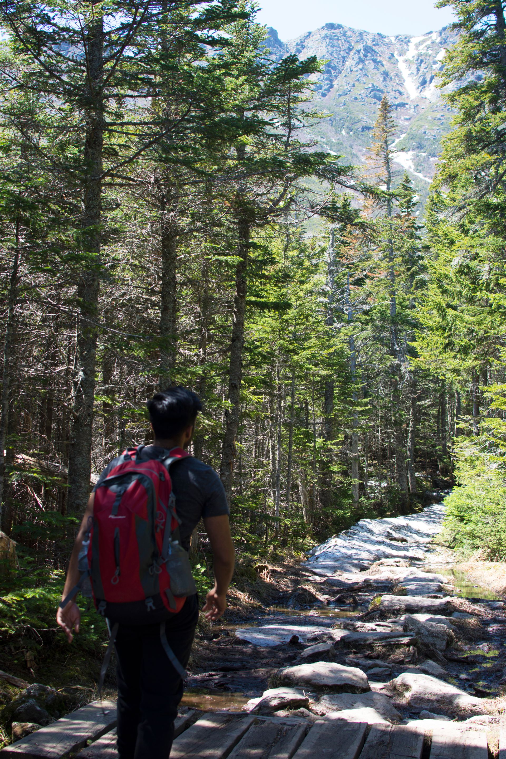
A little less than halfway to the top, the treeline started thinning out. Views of the surrounding New Hampshire mountains honestly stunned me. The atmosphere was slightly hazy, but otherwise great conditions and a beautiful day that really amplified splendor the White Mountains. Up until this point the wind was hardly noticeable. The trees acted as a barrier from the harsh gusts that were almost immediately noticeable out of their protection.
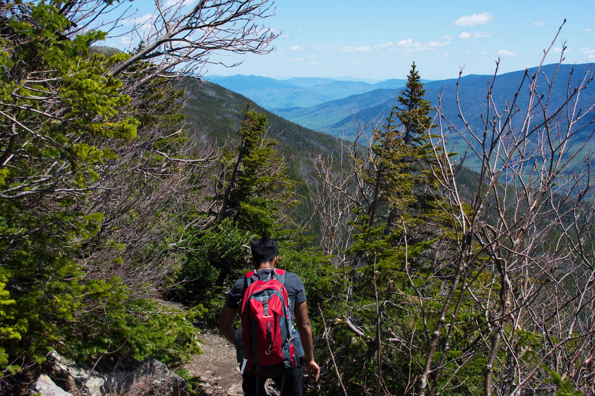
With a little more elevation gain, the forest finally opened, and we could see the mountain range, as well as the summit of Washington.
Completely out of the trees, the wind was a force to be reckoned with. Gusts that day reached over 85 miles an hour - nearly sustained winds from a category 2 hurricane. The wind made everything about the hike more extreme. I had summitted higher peaks and hiked longer trails in the West, but none of them felt like the conditions on Washington. None of them felt like I was on an expedition in Antarctica, battling winds to make each step. I don't think the smile on my face faded until I was out of the wind, it was an amazingly enjoyable experience.
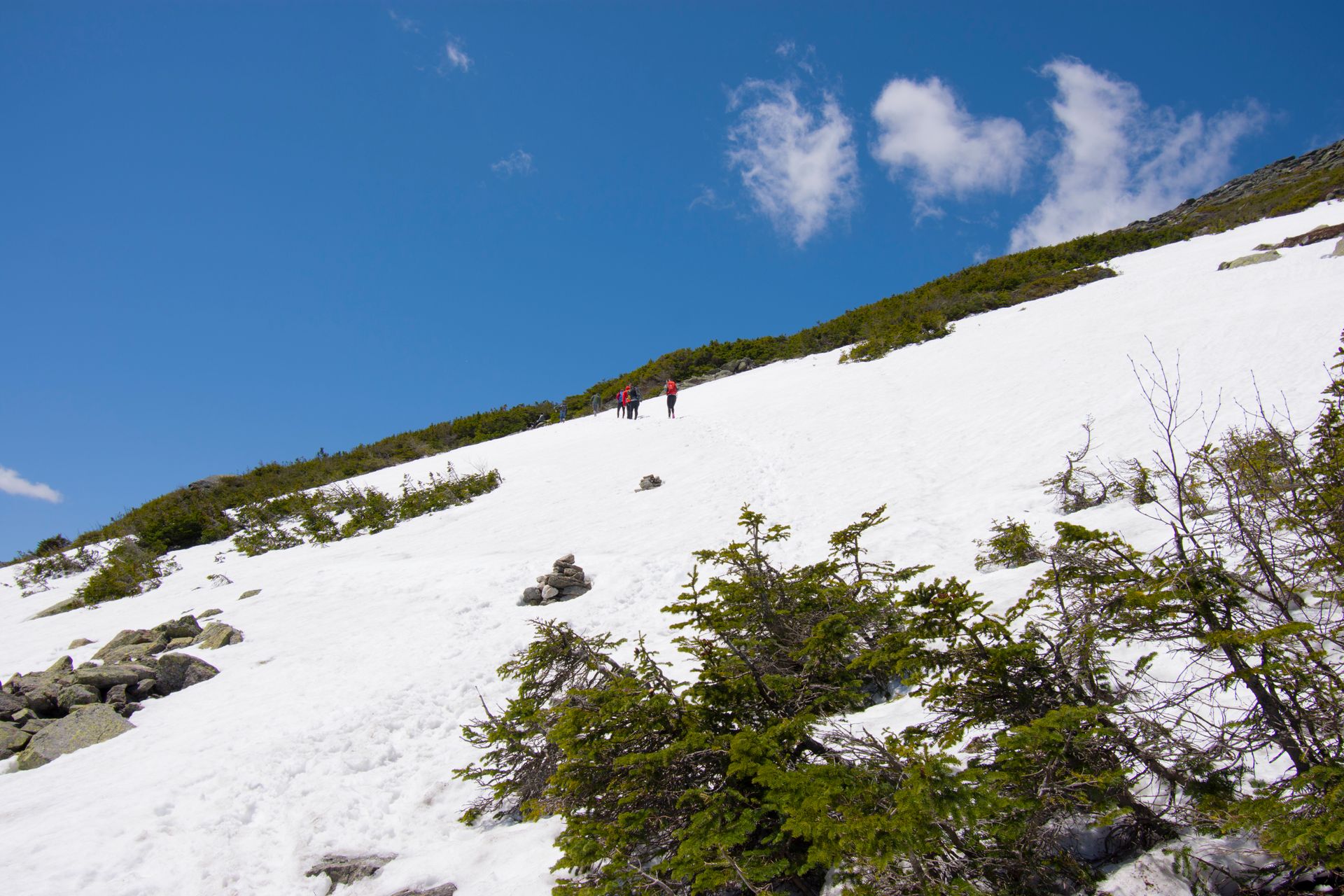
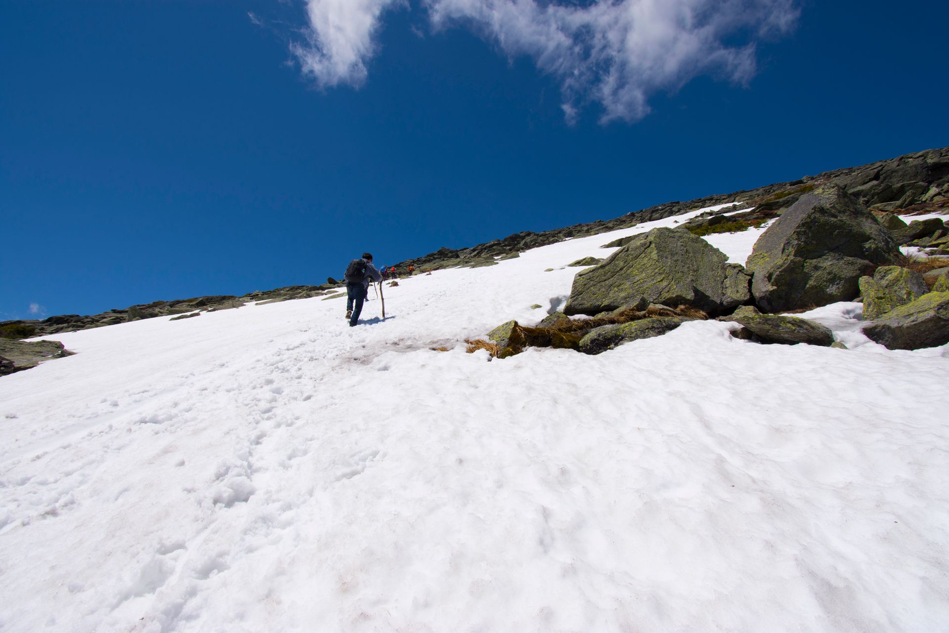
Personally, I am not a fan of hiking in the snow, but because Mt. Washington is so popular, and there was only one way to the summit, the snow was comfortably packed down and hardly annoying. Some places, the snow would be packed until it became ice, making some slopes difficult to gain elevation. But even then, I never felt like I was in danger, as long as you went slow, you were safe.
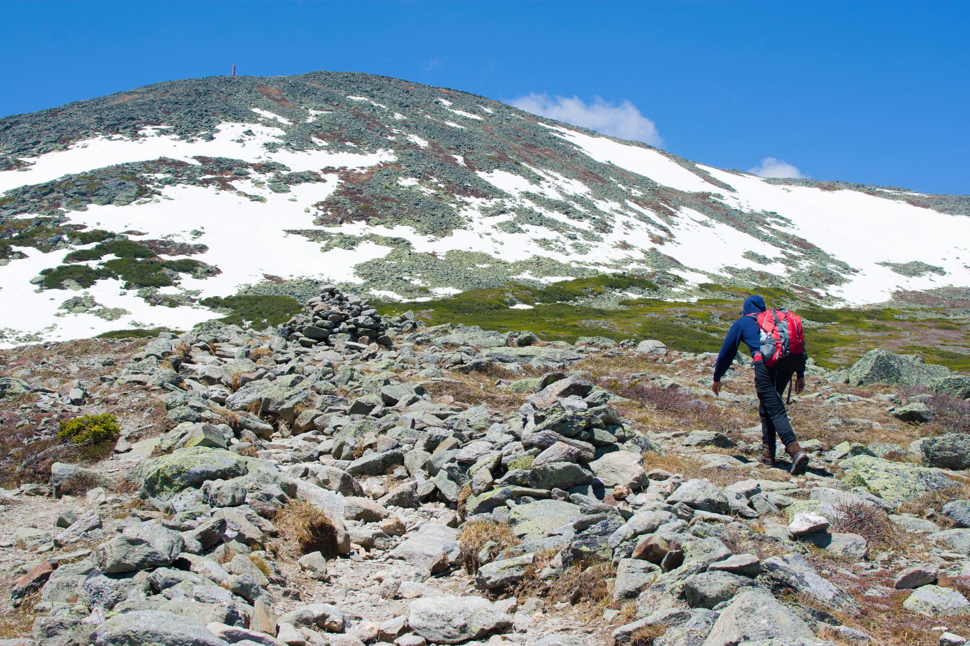
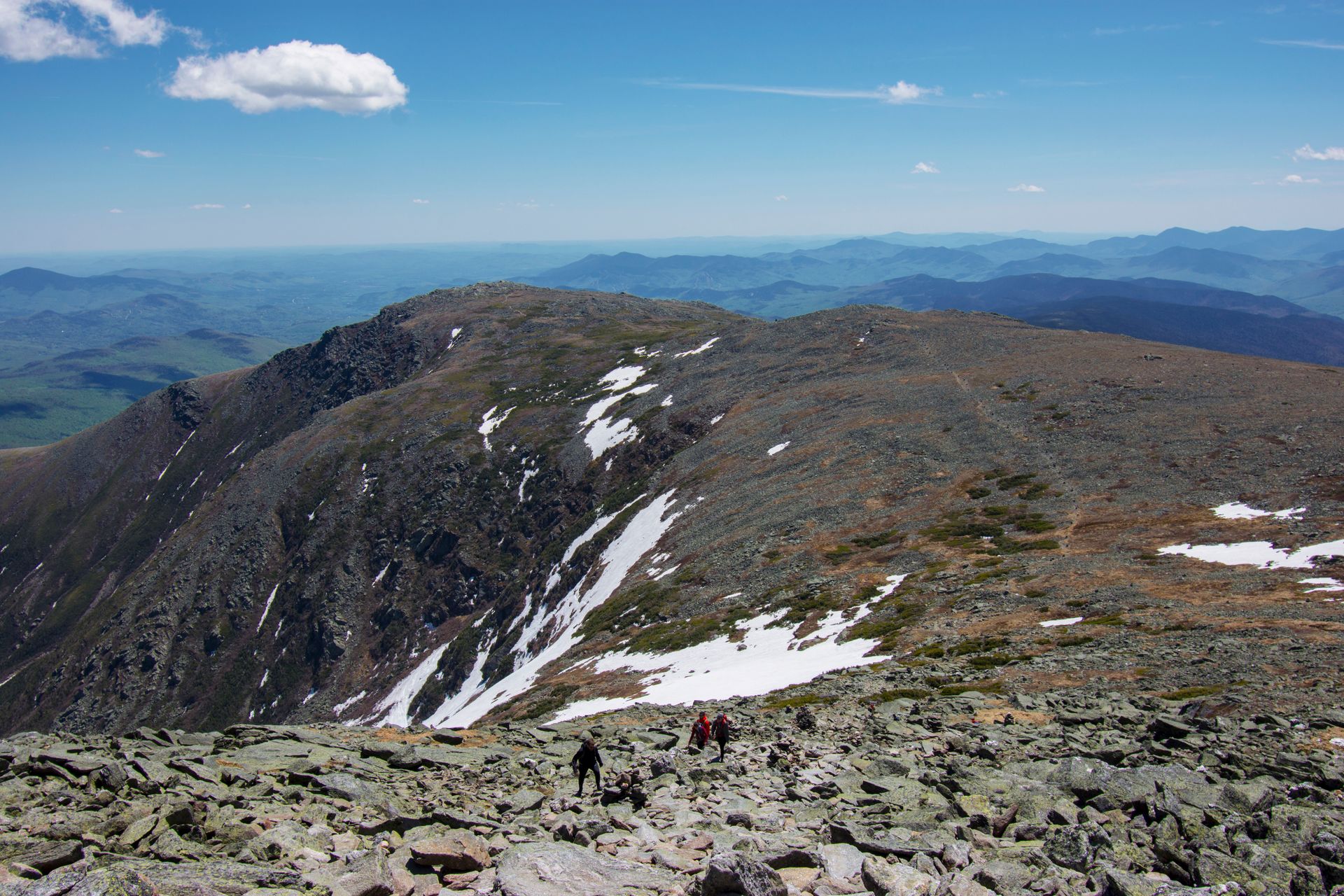
Getting closer to the summit, the rocks and boulders became the size of trucks. Some non-technical bouldering was required to maneuver around some of the larger rocks. Again, it was more fun than dangerous, and I found myself having a great time trying to find the best routes through the field of boulders.
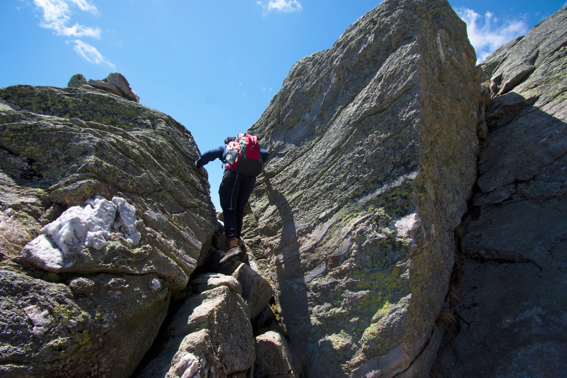
Finally, above the ridge line, Mt. Washington rises high above the other presidents on the Presidential Range. Mountains; Jefferson, Adams, and Madison were all available to hikers, but that would be another trail, a difficult 25 miles journey called the Presidential Traverse. It was too windy to do the whole Traverse the weekend we went, so we settled for Mt. Washington. Notice the cairns lining the trail to the next summit.
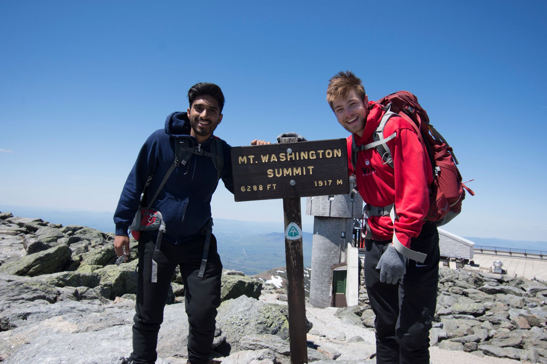
The Top of New Hampshire
The summit of Mt. Washington may not be what you expect. As I mentioned before, there are a few ways to reach the historic summit. There is both an auto road and a trolley that can take you to the top of the mountain. Knowing this the entire way, I told myself not to feel cheated at the top. Even with the mental preparation, I couldn't help but feel a little dissatisfied with my colleagues on the top that didn't decide to hike up. At the summer there is an observation station, a little visitor center, a gift shop, and even a mini mess hall. Instead of getting mad, I took advantage of the mess hall and got myself a warm cup of coffee. I checked out the exhibits and found some fascinating information about the Mountain, and just enjoyed the views from the observation deck.
In all honesty, the road and trolley might have taken away some of the immersion I have come to expect on a summit, it damaged the integrity of them mountain, but I was also glad it was there. There are countless mountains that we can summit that are not accessible to the general public. This gives everyone, even the elderly, to view New Hampshire from the highest point. I just hope it doesn't become a trend for other mountains.
Even so, I had reached the summit the good-ole-fashion way, and I was satisfied with my accomplishment.
I thought the 80 mile and hour gusts were impressive, but it wasn't until I reached the top, and explore some of the exhibits, did I realize just how bad the weather can get on top of Mount Washington. Category 5 hurricanes rarely exceed wind speeds of 150 mph, that is peanuts compared to yearly highs on the mountains. On April 12, 1934 the Mt. Washington observation recorded the highest wind speed ever recorded in the world, topping out at 231 mph! "Century Days" or days where the wind speed is over 100 mph happens every month of the year, and regularly during the winter months. Compared to the mountains out west, Mt. Washington has all of them beat.